The popular perception is that Texas’s metropolitan areas are sprawling all over the place because the state has so much land. The truth of the matter is a little more complicated, however. Yes, all the metros in Texas are sprawling – but they’re densifying as well. And when you “net it out,” the density is winning over the sprawl in the big metros – while the sprawl is winning over the density in the smaller ones.
If urban planners could proactively and precisely identify which buildings and civil structures are less resilient to flooding, not only could interventions be better targeted and more effective, but communities could become more engaged in the process. An interactive, geospatial artificial intelligence-driven platform could be the answer.
The Texas Supreme Court has settled it: Houston's historic preservation ordinance is not a form of zoning, which is expressly banned in the city charter. The decision seems to clear the way for more local experimentation with urban design and development rules.
Just don’t call it zoning.
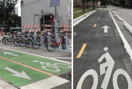
The city has eight months of ideal cycling weather each year and has taken some sizable steps in building out its bike infrastructure in the past decade. But is anyone outside of Houston paying attention?