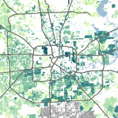
Charting the physical development of a city typically relies on an analysis of land use and Census data. In many cities development is shaped by zoning laws and follows a clear pattern determined by those systems. In Houston, growth is primarily driven by private subdivision development, intentionally stimulated by a unique set of state laws and local political relationships.
The subdivision plat is a document prepared by a surveyor that illustrates the dimensions of the property being developed, the intended use of that property, whether it is a commercial or residential use, the surrounding landowners and the adjoining street right-of-ways. The purpose of this research was to test the viability of using subdivision plat data to analyze urban growth at a more granular level, and to construct a diachronic map of Harris and Fort Bend counties between 1950 and 2015 to illustrate the urban growth within the region. The study confirmed that subdivision plat data are a rich source for the analysis of urban development. Depending on the availability of a subdivision layer, it is possible to access this type of data for any city in the United States and do comparative studies.


