
In May 2016, Houston Mayor Sylvester Turner gave a speech before the Transportation Advocacy Group calling for a “paradigm shift” in transportation planning. He declared, “Houston can’t solve its congestion problems by just building more roads.” The planned expansion of I-45, also known as the North Houston Highway Improvement Project (NHHIP), has been put forth as the $10 billion solution to address traffic, the biggest problem in the Houston area according to respondents of the 2018 Kinder Institute Houston Area Survey. It is understandable then that in anticipation of the projected population growth that is estimated to result in a 61 percent increase in the number of vehicles on our roads by 2045, that the knee-jerk reflex of expanding roads to accommodate more cars is the appropriate route to manage congestion and improve air quality - the stated goals of NHHIP.
However, rethinking the need for the NHHIP is an opportunity to demonstrate that our region is committed to driving transportation planning toward a more thoughtful approach. Transportation policies that have prioritized the building of roads and highway infrastructure, coupled with poor land use planning, have contributed to many health and environmental inequities in Houston. These policy decisions have fragmented and displaced many communities of color, undermined funding for alternative modes of transportation, facilitated a sprawling landscape, which increased the distance between homes and jobs, and advanced residential segregation. These factors have all been shown to contribute to poor and inequitable health outcomes.
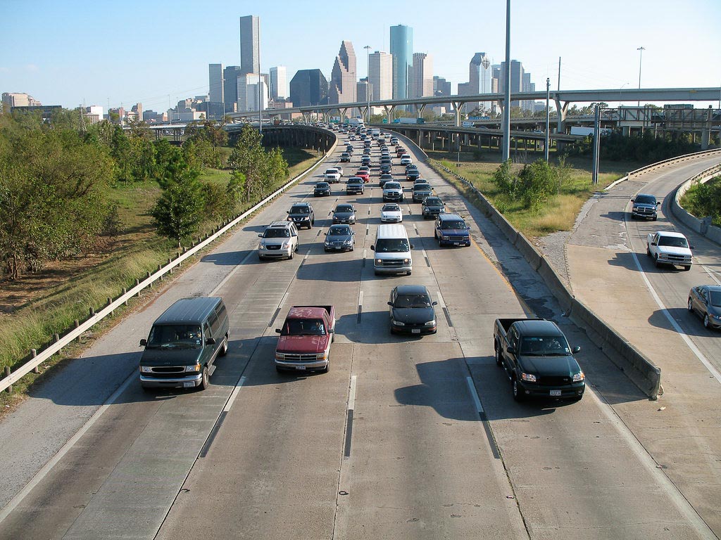
Cars and trucks are already a significant source of air pollution in our region that impacts our air quality and public health. Continuing to expand highways as the primary remedy to address congestion, particularly in a region that fosters development practices that perpetuate sprawl, only fuels our dependence on using single-occupancy vehicles as the dominant transportation choice to move people around. It also contributes to the deterioration of air quality. According to the 2019 American Lung Association State of the Air Report, Houston’s air quality has gradually gotten worse in recent years, now ranking 9th among the top 25 most ozone-polluted cities in the United States. Air toxics from mobile sources, such as benzene and formaldehyde, can cause damage to the immune system, reproductive and neurological disorders, and respiratory problems. Moreover, ground-level ozone – formed in part from pollution from mobile sources – can trigger asthma attacks, inflame and damage airways, and cause chronic obstructive pulmonary disease (COPD).
Research studies have shown that people living or going to school within 500 feet of a high-traffic roadway have increased risks of asthma, impaired lung development, and childhood leukemia, among other illnesses. Not surprisingly, children of color and/or low-income disproportionately attend schools in close proximity to highways and have higher rates of asthma than their peers. While asthma cases attributable to traffic-related air pollution have decreased overall between 2000 and 2010 in the US, exposure to traffic-related PM10, PM2.5, and NO2 still account for 40%, 28%, and 18% of pediatric asthma cases in Harris County, respectively. Similarly, another recent study found that about 400 new pediatric asthma cases per 100,000 children per year in Harris County are attributable to exposure to NO2 from traffic pollution (25% of pediatric asthma cases).
Because the built environment plays a significant role in shaping health outcomes, considering the health impacts before a planned project or policy is implemented is critical. One policy tool that can be leveraged to advance a paradigm shift in transportation planning processes and decision-making is a health impact assessment (HIA). An HIA is a tool used to evaluate the health impacts of proposed projects in order to better inform the decision-making process and identify methods for mitigating potentially adverse impacts. During the past year, Air Alliance Houston conducted an HIA to evaluate the potential health impacts to communities, specifically those impacting schools, school-aged children and their families that live, work, and attend school nearby to help inform decision makers about the project. The HIA focused on nine priority campuses along the I-45 corridor and focused on assessing the air quality, mobility, and flooding impacts of the project.
Based on health indicators from the 500 Cities Dataset, areas surrounding some schools within the Aldine Independent School District (AISD), Bruce Elementary School and Secondary DAEP in Houston Independent School District (HISD), are communities that generally experience worse health outcomes than other areas of Houston, ranking in the highest quartile for six out of the seven indicators that were included in the HIA. Among these campuses, physical health is among the worst in census-tracts surrounding the Aldine schools and Bruce Elementary (HISD). It is also important to note that some of these campuses are within census tracts with extreme rates of poverty. This suggests that any potentially adverse health impacts caused by the NHHIP would likely exacerbate existing conditions and place additional disproportionate burdens on the health of these communities.
The current vehicle miles traveled (VMTs) within 150 meters (500 feet) of the nine schools studied in the HIA averages seven times higher – 70,198 VMTs – compared with the HISD/AISD average of 10,124 VMTs. Air modeling projections from the HIA indicate that hourly benzene exposure levels will increase over 100 percent in some locations near Bruce Elementary. However, mobile air monitoring conducted around the campuses measured higher hourly levels of benzene than the air modeling predictions. Not only are asthma rates at many of the schools along the NHHIP route already higher than each of the school districts average of 3.3 percent, but some campuses, such as Bruce Elementary, also experience a high rate of asthma-related emergency service use. The projected increase in traffic will deteriorate air quality and the health of children and their families that live, work, learn, and play nearby.
The impact on mobility around the nine priority campuses was also assessed. A significant number of pedestrian/bike crashes have occurred within a half mile radius of schools along the NHHIP corridor since 2010 and many of these have occurred under or adjacent to the highway or on preferred pedestrian routes to school. Furthermore, some campuses do not have school zones designated. The current NHHIP design will expand the highway width and increase the speed of cars traveling down access roads, increasing safety concerns for pedestrians and cyclists, many of whom are school children. For example, the expansion design would widen the highway width by as much as 70 percent in some areas and add several more lanes, bringing at least 26 existing school and daycare campuses within 500 feet of the highway.
Many of the schools along the NHHIP corridor are in areas ranked as most prone to dangerous urban heat island effects and/or flooding in Houston. Jefferson Elementary (HISD), for instance, is in the top nine percent of areas most likely to suffer from urban heat island effects, and much of the Aldine Senior High campus sits in both the 100- and 500-year Federal Emergency Management Agency (FEMA) floodplains. The expansion will construct more impermeable concrete surfaces, which could increase flood risk and the urban heat island effect for these communities.
It is anticipated that the NHHIP will disproportionately impact communities of color and low-income, causing displacement, destroying the social fabric of neighborhoods, and severing access to economic opportunities, perpetuating a long history of environmental injustice that contributes to health inequities. A commonly used community health indicator is life expectancy. There is already a 10-year gap in life expectancy between the census tracts surrounding the Young Women’s College Preparatory (YWCP) (82.6 years) and Bruce Elementary (71.8 years) campuses. According to the 2013-2017 American Community Survey, the median household income for the census tract containing YWCP is $96,492 compared to $23,025 for Bruce Elementary census tract. The data for these census tracts follow the same pattern and support research that shows place and health outcomes are inextricably linked. Unless intentional steps are taken to minimize the impacts of NHHIP, it can be anticipated that health inequities will be maintained or exacerbated for residents in these communities.
Houston is now sitting at the proverbial fork in the road. How we choose to move forward with this project is one of many critical decisions that will be made in the near future that will influence the health of our region for decades. We need to get this right, the health of our region depends on it.
Editor's note: This post was updated to correctly locate Aldine Senior High School within the 100- and 500-year floodplain.
Bakeyah Nelson, Ph.D., is the executive director of Air Alliance Houston. The opinions expressed in this commentary are her own.