
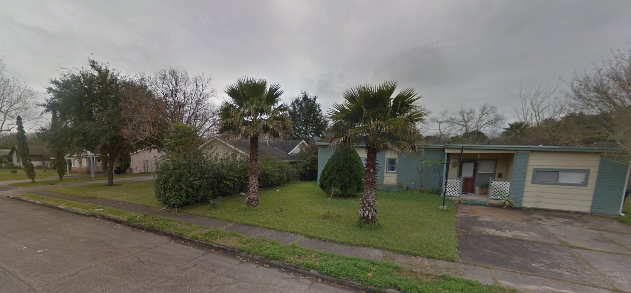
 Residences in the heart of Sharpstown, Houston. Image via Google Streetview.
Frank Sharp built a lot of single-family homes in postwar Houston. As the lead developer on two major single-family subdivisions, Oak Forest (1946) and the so-humbly named Sharpstown (1956), Sharp helped propel Houston’s outward growth and shaped much of Houston’s early suburbia.
Sharp was location savvy. He built Oak Forest just on the other side of what would become the Inner Loop. He donated a 300-foot wide strip of land through his Sharpstown development to ensure that the Southwest Freeway would run through the community.
Both communities quickly gained reputations as idyllic suburban neighborhoods that permitted their mostly middle-class white residents to remove themselves from a changing central city while remaining a close drive to downtown jobs and amenities. While Oak Forest was a relatively spartan, mostly residential development, Sharpstown housed one of the region’s first indoor malls (now PlazAmericas) and touted a golf course, among other amenities. White families snapped up the ranch-style, single-family homes in both communities during the first three decades after World War II.
Similar to other inner-ring suburbs, though, both Oak Forest and Sharpstown began to undergo significant demographic and built environment changes in the 1970s and 1980s. While each area was once removed from the city, development soon surrounded them. Commercial strips grew, and apartment buildings began to dot main roads. These changes, coupled with the shifting racial makeup of residents surrounding both communities, altered many white residents’ perceptions of the community and spurred many homeowners to relocate to newer, second-ring suburbs away from the central city.
Despite these shifts, Oak Forest’s demographic profile remained relatively stable, with white homeowners maintaining a majority throughout the last half of the 20th century. Formerly white areas surrounding the community, especially those along both the north and south side of the Inner Loop, saw increases in Hispanic residents and African-American Houstonians.
Sharpstown’s demographics changed far more drastically. When the price of oil plummeted in the early 1980s, white-collar workers who had been living in apartments and homes through Southwest Houston gave way to an influx of immigrants from across the globe. Seemingly overnight, Sharpstown and neighboring Gulfton transformed into a diverse, dense area populated by new Houstonians from Guatemala, El Salvador and Vietnam. These new residents settled in the apartment buildings initially built for the white-collar energy sectors workers and adapted the businesses, institutions and homes in the surrounding area as best they could to fit their needs.
While Oak Forest and Sharpstown started from the same roots, their demographic and development trajectories over the past several decades have been anything but parallel. "Houston in Flux: Understanding a Decade of Development in the Bayou City" -- the latest report from the Kinder Institute’s Development, Transportation, and Placemaking Program --focuses on demolitions and new construction in Harris County over the past 10 years and highlights the latest shifts in communities such as Oak Forest and Sharpstown.
The physical changes these communities underwent over the last decade is tied to how they developed, or did not develop, in the decades prior. The report and accompanying interactive map (www.houstoninflux.com) serve to quantify and visualize physical changes in the form of demolitions and new construction. These shifts likewise shed light onto anecdotal conceptions of the broader trends in real estate, demographics and public investment reshaping Harris County communities.
Since 2005, the two communities have experienced very different rates of demolition and construction. Nearly 13 percent of all properties within the Oak Forest Community Tabulation Areas(CTA), a data boundary created by the Kinder Institute tied to census tracts, experienced new construction in the past 10 years, a percentage more than four times higher than Sharpstown’s 3.2 percent. Likewise, Oak Forest saw 6.8 percent of properties tied to a demolition permit, almost 10 times Sharpstown’s 0.7 percent.
To a great extent, these percentages mesh with our anecdotal ideas of the two neighborhoods.
Oak Forest, like the Heights or Montrose, is a hot real estate market. New residents are rediscovering the benefits that proximity to downtown and its amenities brings. With house prices climbing in central core neighborhoods, areas like Oak Forest are now experiencing their own building booms. This pressure is exemplified by the high rates of demolition and new construction. This suggests that older homes are being torn down, and newer, likely larger homes, are being put up in their place.
 New Construction, Demolition, and Building Permits in Oak Forest CTA. Image via Kinder Institute.
The Oak Forest map of construction and demolition starkly displays these trends. Any purple property shown on the map is the site of both demolition and new construction. As the map shows, these properties dominate the residents areas east of White Oak Bayou. Of the 1,021 properties issued demolition permits in Oak Forest, fully 84 percent were later the sites of new construction or building permits. In those places, something is torn down, and another structure is put up almost immediately.
This is not the case in Sharpstown. Little change has occurred in the community’s built environment over the past 10 years, despite continued demographic undulations in one of Houston’s most diverse and most dense communities. Residential building stock is aging but not yet being replaced. A low level of investment in non-residential and residential properties alike has stymied major improvements or development except along the highways and major roadways. Many of the older buildings in the area are multi-family units that have simply not been updated.
 Map 2: New Construction, Demolition, and Building Permits in Sharpstown-Braeburn-Westwood CTA. Image via Kinder Institute.
The same map of construction and demolition in Sharpstown shows an almost complete lack of either new residential or non-residential building. The same is true for demolitions, which are few and far between. On the residential side, the persistence of the older stock stems from the fact that property owners are making profits from the older structures and see no reason to incur the cost of building new structures. While homes and apartments in the Sharpstown area are among the most affordable in the city, they are also among the oldest and most poorly maintained.
On the non-residential side a similar stasis has taken hold. Aside from the major investments of social service organizations and educational institutions, little new construction has occurred in the area.
The recent demolition and construction trends in both communities demonstrate how disparate a city’s process of development and redevelopment can be. That two communities built by the same developer to serve the same population can diverge so significantly in a little less than 30 years speaks to the ephemeral nature of a city’s urban fabric. A new population may move in and remake an neighborhood without changing a single building. Or, new residents may have the means to tear down and rebuild an entire community’s building stock.
Frank Sharp probably did not foresee either outcome.
Sharpstown and Oak Forest demonstrate just a few of the fascinating trends that can be explored through the interactive map tied to our recent report. What changes are you seeing in your community? Let us know by tweeting to @RiceKinderInst.