
In 1977, The Rice Design Alliance published The Bayou Strategy, a book of clear analysis of flooding in the Houston area alongside architecture studio proposals for multi-pronged solutions to redesigning the bayous. Many of the ideas are still relevant and echoed today by designers looking to improve the city. It could be said that flooding is a founding issue for the Rice Design Alliance and one that we continue to research and discuss in its publication Cite. The wake of Harvey is a critical time to delve deeper into the archives and understand some of the key findings of previous articles. This is step one in understanding where we need to focus our research and writing next as Houston recovers, rethinks, and rebuilds in the decades ahead.
These articles have been pulled together here from Cite for citizen activists, local designers, journalists, and intellectually curious people everywhere to understand the history of flooding challenges and approaches to its management in Houston. The literature review is organized thematically beginning with 1) understanding Houston’s innate relationship to water and history of flooding, 2) tracking the paradigm shifts in approaches to flood mitigation, 3) a look at precedents and proposals that offer innovative solutions, and, finally, 4) a discussion of risk and a critical view of what remains unanswered as we move forward.
1. Bayou City
From an ecological standpoint it’s critical to understand that Houston is nested within a larger bioregion of the Texas Gulf Coastal Plain. Our bioregion is low and flat with clayey soils that don’t drain or permeate water well. John Jacob takes this large scale regional view in “Learn the Song of our Land,” by positing that, “The surface of the entire upper Gulf Coast of Texas is made up of sediment laid down by rivers.” He calls for preservation of the important prairies and forests at the outer edges of the metropolitan region. These fringe ecosystems have everything to do with flooding within the city because our urban ecosystem is connected to the larger bioregion. Similarly, water connects us all since watersheds exist at nested scales of yard, street, neighborhood, bayou, bay, and coastal plain
The early beginnings of Houston and our relationship to water are summarized well in “H20ouston: In Houston, Water has been as Much Obstacle as Opportunity” by Barrie Scardino Bradley. Her historical perspective frames the founding of our city on managing our water assets for navigation. She then explains the myriad ways that Houston benefited from floods here and in other nearby areas because it allowed us to build reservoirs that gave us the illusion of security from floods, making it temporarily easier to build in flood-prone areas.
2. Curly Engineers and Green Infrastructure
After floods ravaged the city from the 1830s to the 1930s, the Harris County Flood Control District was formed, the Barker and Addicks reservoirs were created, and subsequent responses to flooding were aligned with the national approach by the Army Corps of Engineers: move the water out as fast as possible with concrete channels and straight lines. Thus, many miles of our bayous and streams were lined in concrete; their riverine ecology erased. Houston has worked hard to unlearn these practices of channelization and concrete coverage. In 1966, the approach shifted from concrete channels to “curly engineering” when Buffalo Bayou’s channelization was hard fought by the neighborhoods along it. This sea change occurred thanks to the long time activism of Terry Hershey.
Buffalo Bayou is now lauded nationwide as a successful urban waterway project that provides recreational park space and flood mitigation simultaneously. In 1992, an alternative proposal for the Sims Bayou project marked another shift in the Flood Control District’s approach. The deepened bayou was given a bending, river-like form and the concrete lining is buried beneath soil planted with grasses. Another change in thinking about managing floodwater is visible in Arthur Storey Park where massive detention areas can hold stormwater and function as an amenity. Entering the final construction phase in 2016, Willow Waterhole represents an approach to design for flooding that slows and stores water in detention basins that double as public amenities where the flood infrastructure itself is interesting. The mounds and wetlands of the park are shaped to retain stormwater and are fun to explore, creating a unique park experience for visitors.
The shifts in approach to flood management could be summarized as beginning with fast conveyance and massive storage, then slower conveyance coupled with dispersed detention, and finally towards a multipurpose green infrastructure. Green infrastructure, as Keiji Asakura discusses, is a constructed environment that works with living systems to mimic a natural water cycle, but is not in itself “natural.” The nuances of this difference are well explored in Allyn West’s essay “Synthetic Nature.” West points out that natural-looking should not be confused with naturally-occurring. The engineered lifeless concrete channel has been replaced by a constructed wild or synthetic natural channel.
3. Precedents and Proposals
Much attention has been focused on solving the potential social, economic, and ecological devastation that could be wrought by hurricane-induced storm surge. After Hurricane Katrina hit New Orleans, Cite published a prescient special issue in 2007, guest edited by Jim Blackburn and Thomas Colbert, on the risks Houston faces from hurricanes. In September 2008, Hurricane Ike damaged about 75 percent of Galveston’s homes and wreaked havoc through low-lying areas along Galveston Bay. That destruction served as a wake-up call that helped direct some design and planning focus towards implementing a National Recreation Area for the immediate coastal areas and a series of proposals for resilient design in the East End flats. The storm surge conversation and the subsequent proposals are based in predictable models of how storm surges swell and to what depths. It does not address what happens with unpredictable localized flash flooding or fifty inches of rain accumulation in a storm like Harvey. Thus, proposals that are scalable and can be implemented in multiple locations are needed.
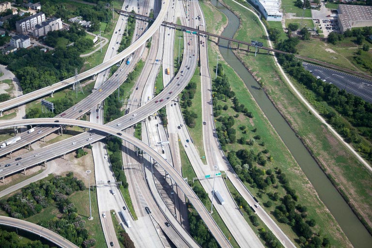
Other proposals and ideas have been implemented with the hope of catalyzing more like it. Completed in 2014, Bagby Street, the city’s pilot Complete Street is a small example of how a street can achieve multiple goals by filtering stormwater and creating great streets for walking and biking. The 2015 master plan for Grisby Square is also aiming for some level of resilient stormwater management while creating walkable transit-oriented urbanism. Natalia Beard at SWA proposes flood resilience through mobile interventions and permanent changes to Airline Drive, which is the site of massive weekend flea markets. There is a relationship between streets for transportation and streets for water movement; the challenges and opportunities of this duality could be better understood. Albert Pope’s essay is a good start because it discusses the disconnect between the hub-and-spoke organization of our car-dependent transportation system and the west to east natural drainage of the bayou flows. This overlay of freeways on top of a different natural logic is one facet of our city’s inability to function in the face of climate change.
The Bayou Greenways 2020 initiative has successfully amplified the network of Bayous by working with the existing natural flows. The project map shows how the bayous thicken into multipurpose “ribbons” for water drainage, water retention, park space, and hike-bike trails.
Bagby Street, Grisby Square, and Bayou Greenways are local case studies in “thick infrastructure” by accomplishing multiple goals at once. We don’t have enough of these examples built locally, so it’s useful to study how Austin is transforming Waller Creek and Shoal Creek into areas for flood control and public trails with an eye towards historic awareness. Raj Mankad’s essay on how TXDOT obliterated an internationally significant burial ground while constructing the Grand Parkway shows that transportation infrastructure must be carefully considered in terms of culture, history, and environmental justice. Street design needs to be at the forefront of our discussions on flooding, and we need better built examples here that are ambitious and grounded in the realities of Houston’s terrain. It is in the neighborhood street where we can more fully address city livability, as asserted by Sheryl Tucker de Vazquez in “Will Houston’s Green Renaissance reach Park Deserts?”
4. Risk
Houston is shaped by water, this we know. Houston has always flooded, but Harvey has shown us, once again, that our efforts at reducing flooding risk are not smart enough. In 2016, Eric Leshinsky raised this question of smart design in his piece, “Designed to Flood: Urban Design in the Age of Unrelenting Floods.” He contends that we have been working on floodplain management and we have already spent billions of dollars to address the issues. He points out that we have many tools at our disposal, but they have not been implemented sufficiently. The pilot projects and small-scale efforts have been hodgepodge and ineffectual at the larger scale because they lack the cohesion, supporting policy, and political will across the region that’s needed to make a meaningful impact.
Perhaps one of the most grim and sobering articles on Houston flooding was written in 2014 by Jim Blackburn, “Liquidation: In the Face of Water Extremes, Houston Cannot Go On with Business as Usual.” He calls out the 100-year floodplain designation as part of our collective denial about how we have come to lessen our expectations of both severity and frequency of storms. The 100- and 500-year benchmarks are not a true representation of flood risk because we have far surpassed the inches of rain that accumulates and how often those rain events occur, as Wesley Highfield documents. Thus, the FEMA maps, flood insurance, and floodplain regulations are based on a system that does not adequately address the true risk. The issue of buyouts is addressed briefly in Blackburn’s article, but a more detailed look at how communities are moved out of flood plains is needed. We have witnessed the debris piles accumulate at the curb in the same flood prone areas again and again. If buyouts of repeatedly flooded properties are the right solution, why haven’t they been more aggressively pursued? And if our benchmarks for floodplains are all wrong, how do we verify that we are buying out enough land? Perhaps the devastation of Harvey will motivate an aggressive buyout program and raising of slab-on-grade foundations to well above the so-called 100-year floodplain. In addition to buyouts, we need more strategies that anticipate the inevitability of flooding with planning and design that responds accordingly.
After Harvey, Danny Samuels observed that the piles of debris outside new construction, built at higher elevations, are smaller than houses built on slabs before building codes were tied to floodplain maps. He notes that building codes appear to have mattered more than zoning. Jack Murphy underscores this point in his article revisiting buildings featured in Rice Design Alliance’s 2017 “H2Ouston: Living in Floodplains” tour. Will robust studies confirm these anecdotal observations after Harvey?
In reviewing Houston’s history of flood response it’s evident that change has come incrementally over an extended timeframe. Big, complex questions loom unanswered while our previously hidden vulnerabilities and inequities come into full view. Take for example that the conversation around storm surge protections prioritizes the importance of protecting the petrochemical infrastructure concentrated around the Ship Channel. Oil and Gas represents a hugely important part of our current economic vitality. Yet, the system and the building practices and transportation planning it supports are extremely fragile in the face of climate change. Add to that the environmental injustices of people exposed to the toxins from the oil and gas industry and the problems feel overwhelming in their scope.
Yet “An Optimistic Response to Harvey” highlights that we have, in fact, created meaningful change in our community. Perhaps we should turn our attention to asking the right questions first, like how can a flood responsive city rely on climate-adaptive industries instead of on ones that contribute to climate-change-induced flooding? The second part of Albert Pope’s essay, “WaterBorne: Finding the next Houston in Bayou Greenways 2020,” touches on these relationships between energy consumption, infrastructure, and flooding for a comprehensive and holistic view of our city’s interconnected parts. Ian McHarg’s approach to The Woodlands master plan, and more recent iterations along Houston’s fringes at Cross Creek, Springwoods Village, and elsewhere, are additional case studies for using floodplains as thickened green spaces.
We need not only thick infrastructure as seen in pilot projects and case studies but a thick city and region that functions well when the weather is dry and then don’t completely fail when it rains. What are the design responses for making that reality? Flood resiliency, not sustainability or benchmarks, needs analysis and a developed framework so that designers can respond, policies can be shaped, and funds raised for flood project implementation that lasts.
Further Reading
- Beard, Natalia. “Airline Market Mile: Inclusive Design for Growth.” Cite 94. Spring 2014. OffCite.org. July 22, 2014.
- Blackburn, Jim. “Liquidation: If Houston is to be a Resilient City in the Face of Water Extremes, We Cannot Go On with Business as Usual.” Cite 93. Winter 2014. OffCite.org. May 27, 2015.
- Bradley, Barrie Scardino. “H20uston: How Water Shaped the Bayou City.” Cite 46. Fall 1999. OffCite.org. April 25, 2016.
- Crossley, Jay Blazek. “Complete Streets Are Coming to Your Neighborhood Soon. We Hope.” OffCite.org. August 27, 2014.
- Flaherty, Tom. “Hit Hard in Meyerland: A Photo Essay.” OffCite.org. June 4, 2015.
- Hamilton, Ann. “‘We Just Need Some Curly Engineers’: Terry Hershey in Her Own Words.” OffCite.org. March 6, 2017.
- Hight, Christopher. “Last Resorts: Proposals for Galveston’s East End Flats.” OffCite.org. July 9, 2010.
- Jacob, John. “Learn the Song of Our Land.” Cite 93. Winter 2014.
- Joseph, Cheryl. “Mid-Century Elevated: How an Architecturally Significant House was Lifted Above the Floodplain.” OffCite.org. September 25, 2017.
- Leshinsky, Eric. “Designed to Flood: Urban Design in the Age of Unrelenting Floods.” Cite 99. Winter 2016.
- Mankad, Raj. “Buried Concrete.” Cite 86. Summer 2011.
- Mankad, Raj. “A Heartbreaking Loss: Grand Parkway Segment E Ruins Site of International Significance.” OffCite.org. December 18, 2012.
- Mankad, Raj. “Houston Has a Woonerf.” OffCite.org. October 20, 2015.
- Mankad, Raj. “Living in Floodplains: Expert Recommendations Before Harvey Still Ring True.” OffCite.org. October 2, 2017.
- Mankad, Raj. “Thick Infrastructure: Reconnecting by Way of What Divides Us.” OffCite.org. May 23, 2003.
- Murphy, Jack. “Artificially Natural: On the Transformation of Austin’s Waller Creek.” OffCite.org. March 24, 2017.
- Murphy, Jack. “Watershed Urbanism: Shoal Creek’s Infrastructural Future.” OffCite.org. March 30, 2017.
- Murphy, Jack. “Design Could Save Your Life: Revisiting the H2Ouston Living in Floodplains Tour.” OffCite.org. October 16, 2017.
- “An Optimistic Response to Harvey.” OffCite.org. August 31, 2017.
- Pope, Albert. “WaterBorne: Finding the Next Houston in Bayou Greenways 2020.” Cite 97. Summer 2015. OffCite.org. March 21, 2016.
- Samuels, Danny. “Harvey Musings: “Zoning made no difference. But stricter building codes did.” OffCite.org. September 4, 2017.
- Sheehy, Sandy. “Sustainability: Coastal Tourism as Protection for Wetlands.” Cite 89. Summer 2012. OffCite.org. November 14, 2012.
- Tang, Florence. “How the Barker and Addicks Dams Work.” OffCite.org. September 4, 2017.
- de Vazquez, Sheryl Tucker. “Will Houston’s Green Renaissance Reach Park Deserts?” Cite 99. Winter 2016.
- Vest, Geneva. “Post-Harvey Houston Can Learn from Suburbs Designed with Nature.” OffCite.org. October 6, 2017.
- Whiting, Sarah. “A Green New Deal: Recommended Readings on Hurricane Harvey.” OffCite.org. September 8, 2017.
- West, Allyn. “Synthetic Nature.” Cite 99. Winter 2016.
Falon Mihalic is an artist inspired by the landscape experience. This story originally appeared on OffCite, a blog for Cite magazine.