
Walkability is the subject of an ongoing debate in Houston. Although some voices consider the Southern metropolis a textbook example of sprawl; others see opportunities for change, highlighting infrastructure needs and calling for more walking-friendly regulations. Furthermore, the city has kickstarted a series of initiatives to foster walkability, including the planning department’s Walkable Places Committee and the mayor’s Complete Communities initiative, which includes walkability as part of a larger effort to improve neighborhoods.
In my experience as a European who regularly visits Houston and more often relies on sidewalks and public transit than cars for transportation, I’ve always found Houston a lot more nuanced, varied and interesting than the usual “sprawl capital” title suggests. Inspired by a recent New York Times map, I decided to use Geographic Data Science to capture this impression in a series of maps that answer the simple question:
How many buildings can you reach within a 15-minute walk in different Houston-area neighborhoods?
Walkability is the result of two factors: density and accessibility. Density has a key role in enabling people to access more buildings within a given time, as areas with higher density can "pack" more buildings per square mile. But buildings also need to be accessible, a product, in part, of the street network that connects them. Large pieces of infrastructure such as highways, or natural features such as bayous act as barriers that disconnect places otherwise nearby. This interplay between density and accessibility helps determine how walkable a location is, making the maps below more complex (and interesting!) than if the city was a perfect, uniform blanket of buildings.
I see the maps below as a sketch of the diverse, multi-faceted city that Houston is.
Let’s start with one that supports the “Houston is a textbook example of urban sprawl” camp, just outside the city:
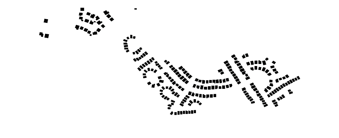
Sienna Plantation. Map: Daniel Arribas-Bel.
By my own computations, a 15-minute walk in the suburban area of Sienna Plantation, in Fort Bend County, will let you reach 233 buildings.
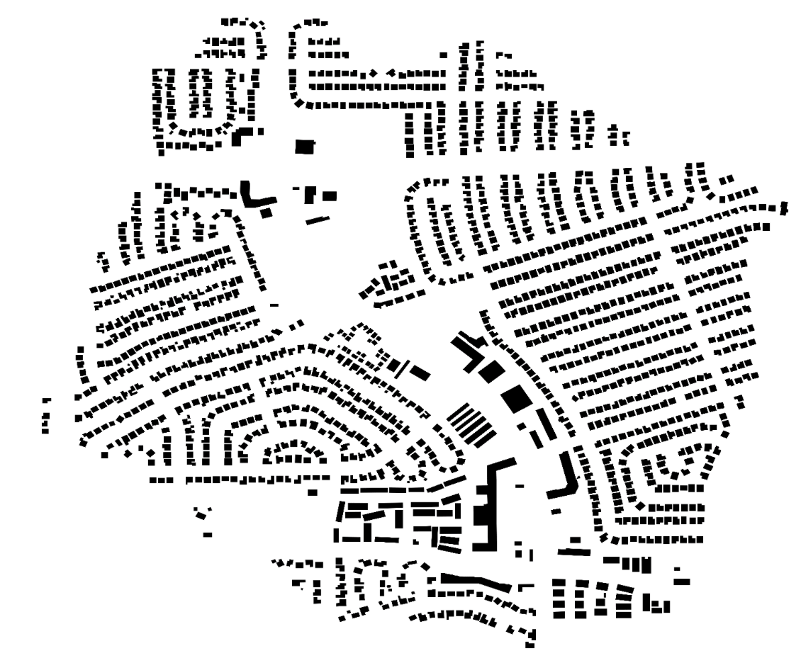
However, let’s contrast that with the map of The Heights, one of the first suburbs in Houston, just north of Downtown:
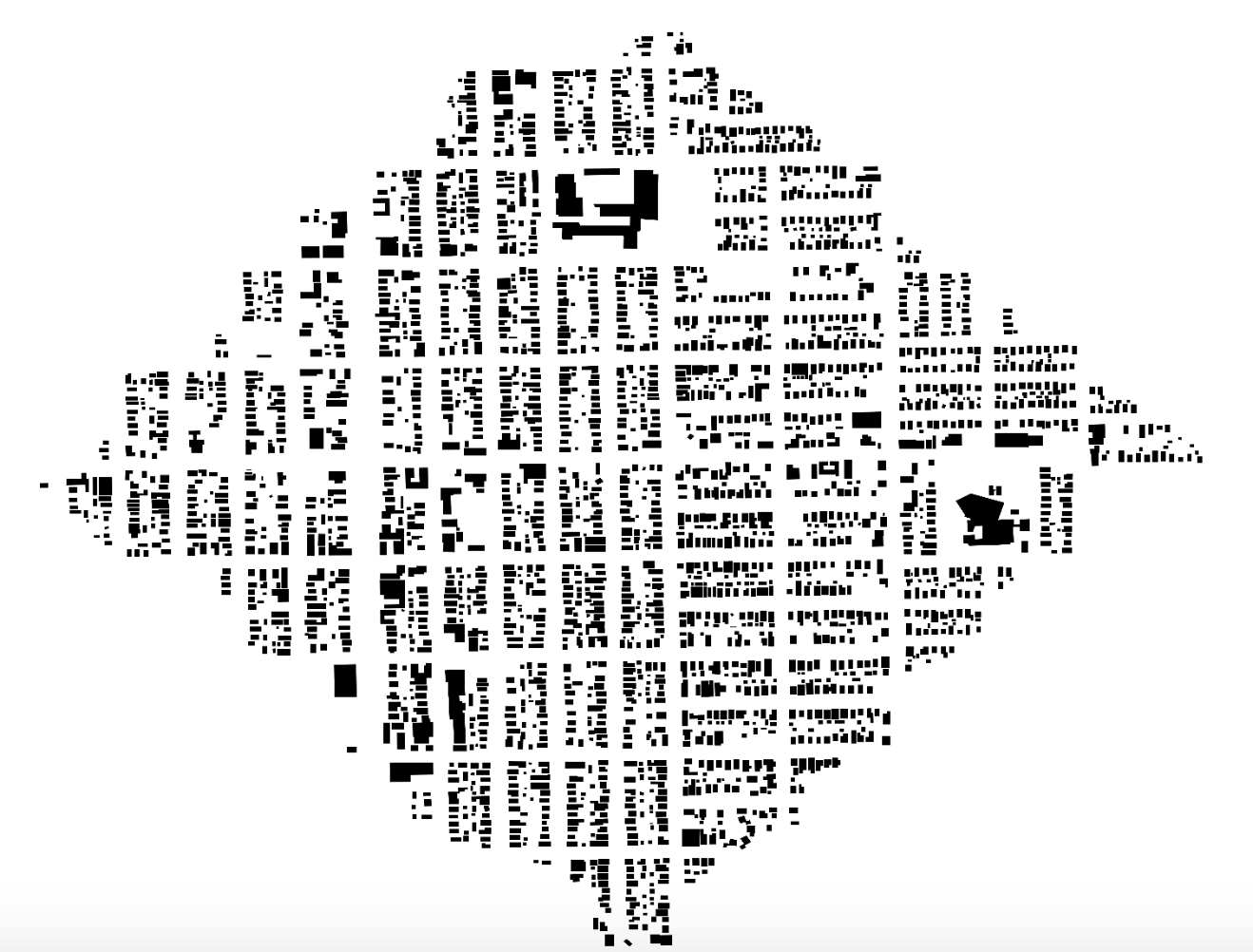
The Heights. Map: Daniel Arribas-Bel.
As the map above shows, the amount of places you can reach within 15 minutes dramatically increases for the historic inner-ring suburb community that was organized around a streetcar line. In fact, you could explore 2,618 buildings, more than 10 times that of Sienna Plantation, a typical modern suburban development.
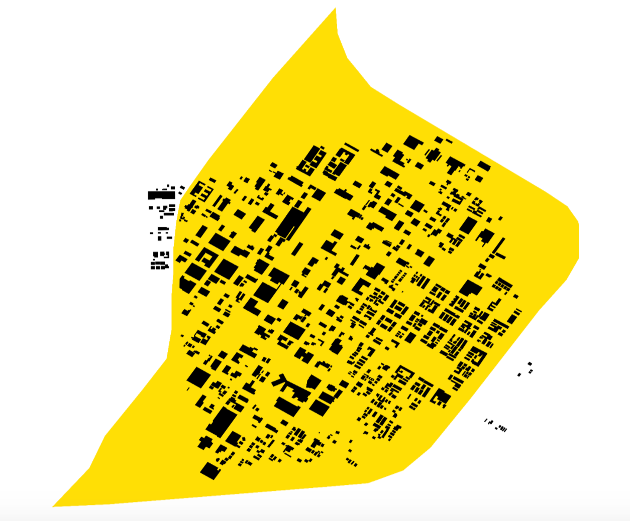
Let’s turn to some of the neighborhoods the city has prioritized for improving walkability. The map below shows the Walkable Places pilot area along Third Ward’s Emancipation Avenue (yellow). As you can see, the area sits at the division between the more scattered eastern side, where plots are larger and, thus, houses farther apart from each other, and the more tightly packed west:
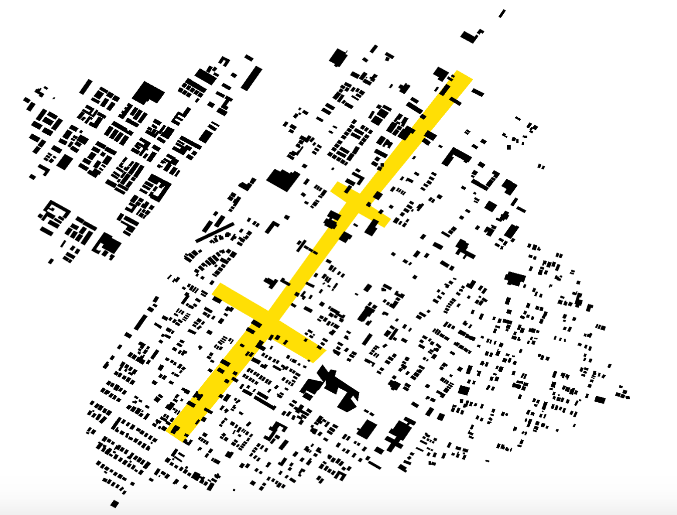
Emancipation Avenue in Third Ward. Map: Daniel Arribas-Bel.
The map also makes explicit, by absence rather than presence, the role of big transportation infrastructure: the wide empty space that cuts diagonally across the left side of the map corresponds to State Highway 288, and presents a clear barrier to walkability in the area.
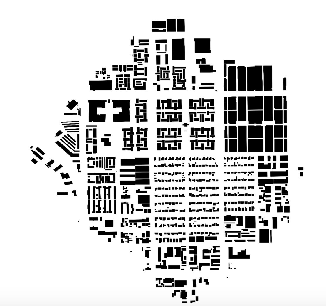
Another contrast can be found in Midtown, another Walkable Places pilot area, where the mix of uses and styles is clearly embedded in the building signature through their size, shape and amount of open space surrounding each. There are smaller, regular residential footprints; larger condominiums and community buildings; and even big empty spaces, which are either parks, parking lots or construction areas:
Midtown. Map: Daniel Arribas-Bel.
We will finish this virtual tour in two areas that are the focus of the first round of the Complete Communities initiative.
Acres Homes. Map: Daniel Arribas-Bel.
The Acres Homes neighborhood features a regular residential pattern surrounding the larger, more spaced buildings at the core, which is a reminder of its early development as a community of lots divided by the acre.
Compare that to my favorite, Gulfton, where densities are similar to East Coast cities and the map looks likes anything but the suburban sprawl blanket some people are convinced Houston is:
Gulfton. Map: Daniel Arribas-Bel.
If you’re interested in the geeky details, such as the technology behind the maps, have a look at the computational notebook I used. Above all, this exercise is an invitation to explore the geography of the city through its building footprints and reimagine how we see its built environment. Maybe it will also make you step out and take a 15-minute stroll of your neighborhood?
Daniel Arribas-Bel is a senior lecturer in Geographic Data Science at the Department of Geography and Planning, and member of the Geographic Data Science Lab, at the University of Liverpool (UK).