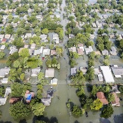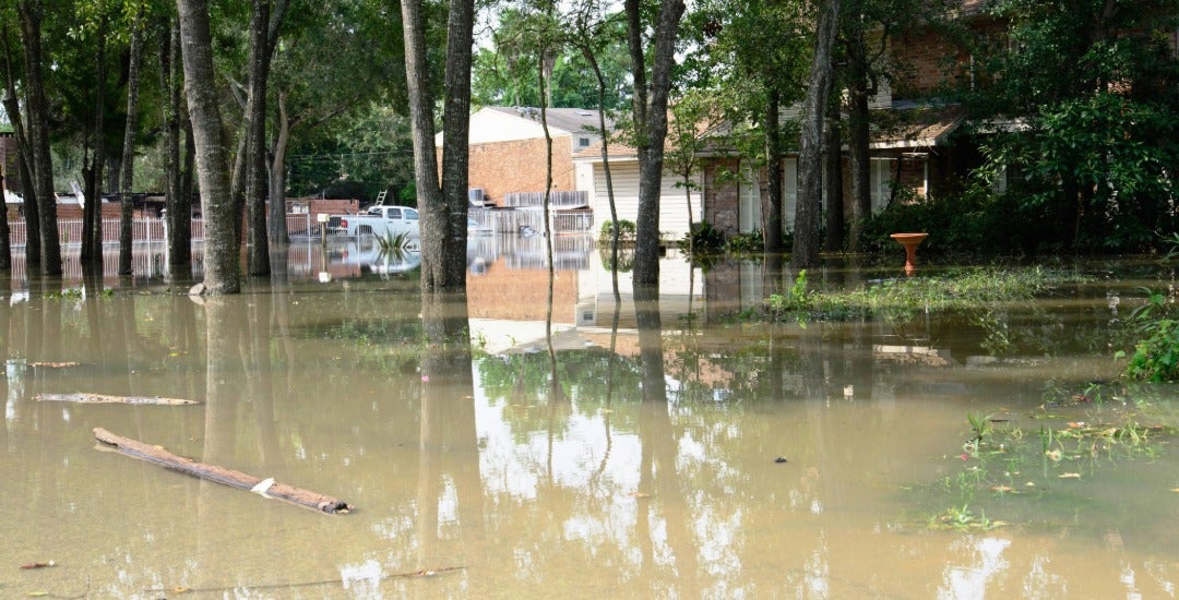
Hundreds of thousands of Harris County residents would move into higher-risk flood zones under a proposed update to federal maps — but only some residents would see insurance hikes as a result.
Recent changes to the federal government’s method of calculating flood insurance premiums have largely taken flood maps out of the equation, lessening the impact of the long-awaited redrawing of risk boundaries in Harris County. The switch to a more sophisticated analysis of flooding risk means only a slice of Harris County’s 1.8 million households face noticeable insurance increases in the coming years as a result of the maps.
Any insurance price hikes will further burden the roughly one-third of Harris County residents who are struggling to afford housing and cite insurance costs as a contributing factor, according to a late 2024 Kinder Institute survey of 5,000-plus people.
For the moment, it’s impossible to say how many residents will feel the financial effects of the redrawn maps, which still must undergo a monthslong review process before final approval.
What is clear, however, is that only one larger group of property owners — those with properties moved into the 100-year flood plain, who didn’t previously have flood insurance and currently have a federally backed mortgage — is virtually guaranteed to shoulder new costs likely to exceed $1,000 annually. Available data suggests this group could total more than 100,000 properties, though estimates are difficult to narrow down.
As more details of the federal government’s plans emerge, here’s what we know and don’t know about the imminent impact of the redrawn maps on insurance costs.
How are flood maps and flood insurance costs linked?
Historically, well over 90% of flood insurance policyholders in the U.S. have obtained their coverage through the federal government’s National Flood Insurance Program. For decades, the NFIP used locations within flood zones on federal maps as a major factor in determining insurance premium prices.
That changed in the early 2020s under a new system called Risk Rating 2.0, which uses 30-plus data points to better measure each property’s vulnerability to flooding. Location in a flood map is not a factor, so premium calculations shouldn’t change under the updated maps.
“The flood maps and flood insurance costs were linked at the hip,” said Burl Daniel, a flood insurance expert witness and former insurance industry executive based in Fort Worth. “In the old system, your flood zone on the map was a major driver of your rate. Now, FEMA looks at far more property-specific factors.”
However, one major rule affecting Harris County has remained the same. Under federal law, all owners of properties located within a 100-year flood plain who have a federally backed mortgage on the property must obtain flood insurance.
Private insurers, which issued about 5% of flood insurance policies in 2024, according to Fitch Ratings, can use their own methods for calculating premiums.
How many properties are moving into a 100-year flood plain, and how many residents will need insurance now?
A Houston Chronicle analysis published this week shows the number of Harris County properties located in the 100-year flood plain would more than double, from roughly 158,500 to 330,000.
The federal government hasn’t published data showing how many owners of properties moving into the 100-year flood plain don’t have flood insurance and have a federally backed mortgage.
However, federal data does show about 240,100 policies in effect in Harris County through the NFIP at the end of last year — a figure well below the 330,000 properties located in the 100-year flood plain under the proposed maps. (A single property might be covered by multiple policies, particularly if an owner and renters have separate policies.)
How much does flood insurance cost in Harris County?
Flood insurance premiums are highly variable. Key factors include the value of a property, its proximity to bodies of water, the amount of insurance coverage obtained and the type of structure insured.
“If you’re in a higher-risk flood zone, you’re going to pay more,” Daniel said. “If you’re on higher ground in a lower-risk zone, your premiums are going to reflect that.”
In Harris County, the 240,100 NFIP policyholders paid about $285 million in insurance premiums and associated fees last year — an average totaling just shy of $1,200. The payments did not include deductibles or other claims-related costs.
What happens to residents moving into a 100-year flood plain who don’t get flood insurance?
If a property owner is required to obtain flood insurance but doesn’t purchase it, a mortgage lender can buy insurance for the property and pass along the costs to the owner. This process is called “force-placed insurance.”
Property owners who fail to pay force-placed insurance costs can be deemed in default of their mortgage, potentially triggering late fees and foreclosure proceedings.
While uninsured homeowners might be eligible for federal disaster assistance programs after a major storm, under FEMA's “obtain and maintain" requirement, the government essentially grants them one pass.
If a homeowner receives federal aid for flood damage and the property is in a designated high-risk area, federal rules require them to purchase and maintain flood insurance for the life of the property. Homeowners who do not purchase and maintain the required coverage can be deemed ineligible for future federal disaster assistance for flood damage.
How will people moving into a 500-year flood plain be affected?
They should see minimal to no impact. Property owners in the 500-year flood plain are not required to buy flood insurance, and the NFIP doesn’t use flood maps to determine their premiums.
The Houston Chronicle analysis forecasts the number of properties in the 500-year flood plain will increase from about 180,500 to 308,100.
Additional reporting by Kinder Institute staff writer John Brannen.