
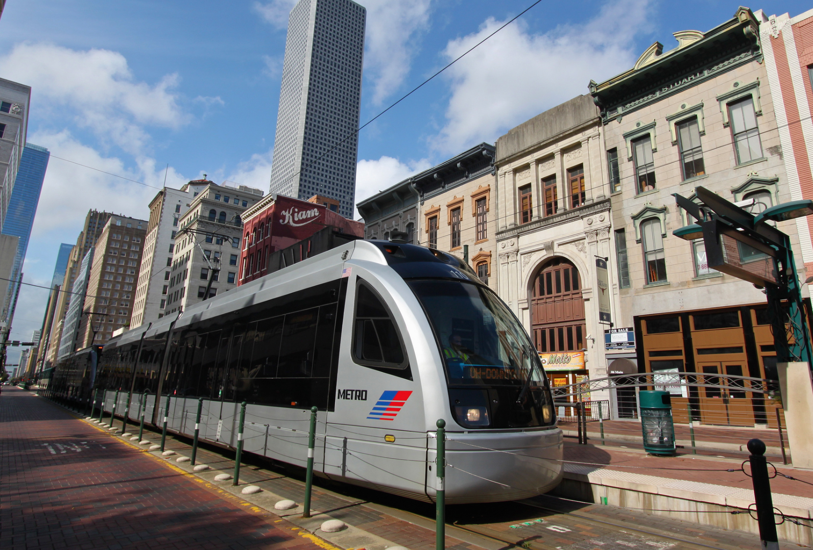
While many of the largest metropolitan areas are confronting declining transit ridership numbers, Houston has seen relatively strong numbers after a 2015 bus route redesign. Still, there are areas for improvement, particularly as the Metropolitan Transit Authority undergoes its long-term planning process.
In a new report, we document neighborhoods where ridership seems to underperform expected levels. Based on statistical analyses using the current ridership, neighborhood characteristics, public transportation services, land uses, activity centers and other indicators, the report highlights several neighborhoods where there are opportunities to improve public transportation service.
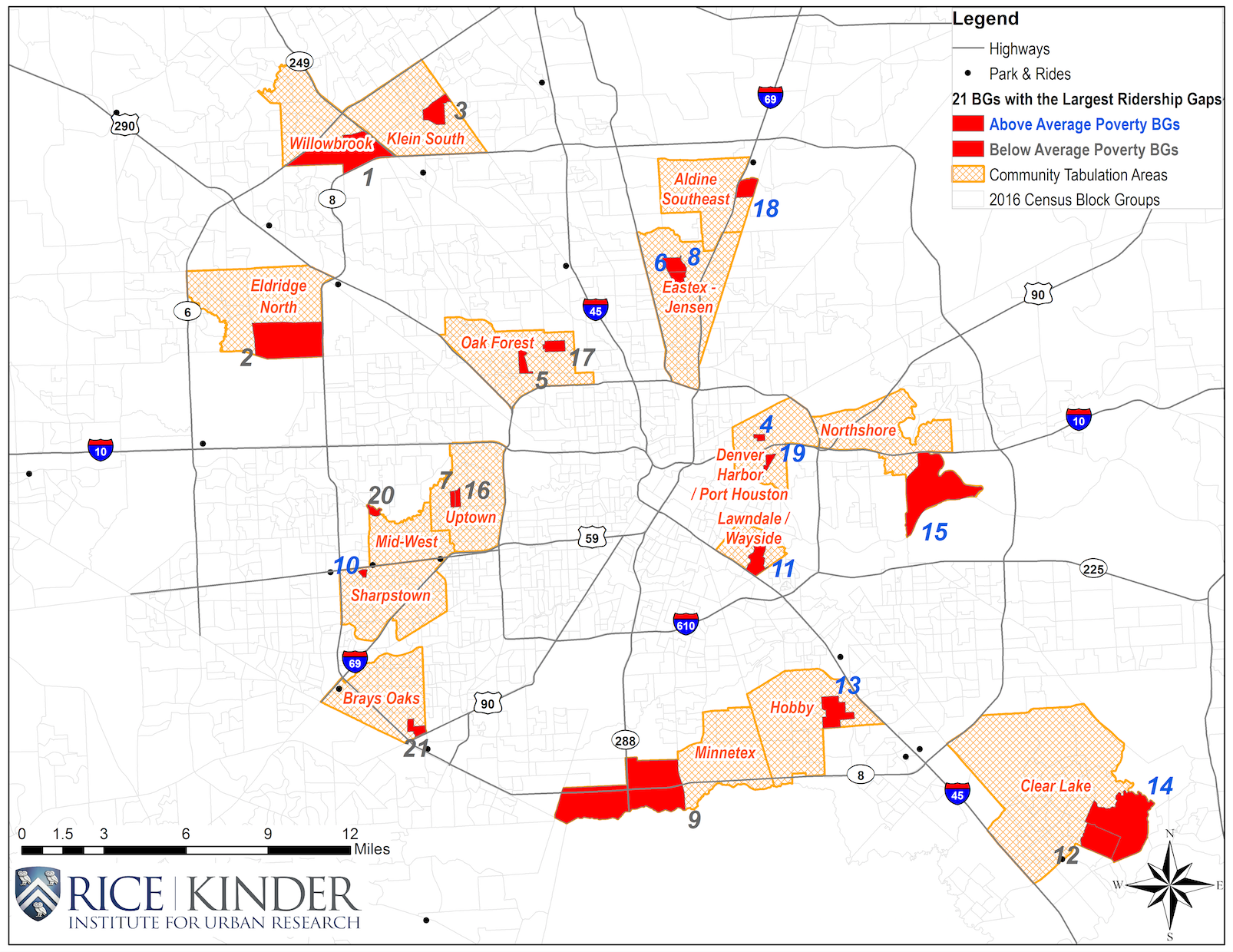
On the east side of Houston, several neighborhoods, indicated with blue numbers, that had a higher poverty rate than the county average also had a relatively low current level of ridership when compared to expected numbers. The block groups in this category are numbered 4, 6, 8, 10, 11, 13, 14, 15, 18 and 19. These areas, including Denver Harbor and Lawndale, could benefit from additional attention and investment in public transit. Lower than expected ridership can reflect a number of factors, not just service frequency or availability of routes, but also the quality of the built environment. Things like safe sidewalk conditions and bike-friendly lanes matter for a neighborhood’s overall mobility and connectivity. Weather is another important factor in Houston, but it can be mitigated with transit stops that include a shelter, roof or natural tree shade. Designs should be universally accessible, and the built environment should support that. Digital screens with anticipated wait times can help make using transit more convenient.
Housing affordability or rental burden is another important factor that should be considered in transit planning. Many residents in the neighborhoods in blue on the map spend more than 30 percent of their household income on rent. The median rent in such neighborhoods is lower than the county’s average, but the median household income in these areas is much lower than that of the county. This underscores the need for affordable transportation options in such neighborhoods.
Access to opportunity should also be part of trasnit planning. Convenient transportation options should be established from these neighborhoods to main job centers that low-income families may work more frequently. The type of transit matters too. An extension of the current rail system eventually could bring more reliability to the transit system. Bus riders, transferring from one bus to another, might have less confidence and consistency, while rail systems can offer passengers more confidence when it comes to commuting time in peak-hours. Connecting other major job centers, like Uptown/the Galleria and Upper Kirby/Greenway, by rail should be considered. Airport connections with some type of rail system, including an express service, should be seriously considered. Houston is one of few major cities that does not have a rail connection to its major airports. The future high-speed rail station should not be a standalone facility but has to be linked with an existing local light rail line.
Other neighborhoods, shown with gray numbers, present a different challenge. The block groups in this category are numbered 1, 2, 3, 5, 7, 9, 12, 16, 17, 20 and 21. These neighborhoods had lower poverty rates than the county average but still showed a gap between existing and potential ridership. In higher-income areas that seem to underperform, transit providers might have to target some drivers, switching them to occasional transit riders, when both quality and quantity of the transit service meet the needs of residents in such neighborhoods, like Uptown and Oak Forest.
These days ride-sharing services like Uber and Lyft are attracting many drivers and people considered to be public transit choice riders. Some studies, including from the Institute of Transportation Studies at the University of California, Davis, present mixed evidence but suggest that ride-hailing services can complement transit use. Autonomous vehicles, likewise, present a potential disruption. Understanding how ride-sharing and ride-hailing services, self-driving cars and affordable hybrid vehicles might affect transit ridership is critical for future transit rider demand estimations.
As that fate of so many metropolitan area transit networks show, increasing demand for public transit and getting drivers out of their vehicles takes work and planning. METRONext expects the regional population to grow by as many as 10 million in 2040. With traffic consistently ranking among the Houston area's top concerns in the Kinder Houston Area Survey, effective transit must be part of the solution. Our new report can help identify some of the Houston neighborhoods that could benefit from further and better public transportation service to support growing demand for transportation solutions in the Houston area.