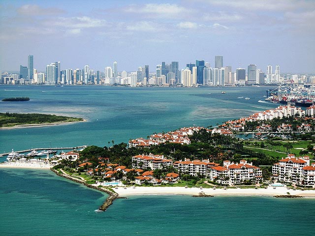
 Downtown Miami, with Fisher Island in the foreground. Image via flickr/Mohmed Althani.
Miami Beach’s sea level is rising faster than the global average, and it’s making major floods there more common, according to a new study from researchers at University of Miami’s Rosenstiel School of Marine and Atmospheric Science.
The researchers suggest two ways regions can better prepare for sea-level rise based on their results.
Regions should project local sea-level rises, rather than relying on global averages, to determine the likely effects rising sea levels will have on their communities, the researchers argue.
Coastal cities should also invest in new drainage systems if they still rely on traditional, gravity-based systems.
The study was published in the latest issue of the journal Ocean and Coastal Management.
The researchers analyzed how often it floods and what caused each flood in Miami Beach from 1998 to 2013. They pulled from five data sets: tide gauges, rain gauges, media reports, insurance claims and photos.
They omitted floods caused by storm surges because they result from anomalous events. Instead, they focused on flooding caused by heavy rain and flooding caused by tides alone, or “sunny sky flooding.”
Their analysis found that tidal flooding has increased dramatically since 2006, and rain-induced flooding is up as well.
Article continues below chart.

In the eight years beginning in 2006, Miami Beach flooded due to rain 15 times and from tidal shifts 16 times. In the eight years previous, rain caused nine floods while tides caused just two.
During the same time that floods have become more frequent, sea-level rise has accelerated in South Florida. Before 2006, the sea level was rising in the region by 3 millimeters per year; after 2006, sea-level rise quickened to 9 millimeters per year.
In other words, flooding events in Miami Beach increased 66 percent after 2006 – a jump that also coincided with acceleration in sea-level rise in the region.
Usually, when researchers gauge coastal flooding hazards, they consider the effects of average sea-level rise on a specific area based on its population, elevation and economic value. Basically, they assume the sea will rise by the same rate everywhere, and then measure what will be underwater if that increase takes place.
But that method has a major shortcoming: it misses out on the possibility that sea-level rise might be happening more quickly in some locations than others. It also can’t account for the effect of flooding due to rain – even though sea-level rise and floods caused by rain are related.
Why’s that? Many cities rely on gravity-based drainage systems – flood drainage that merely allows water to flow naturally from streets into storm drains and out of the system. Those systems are less effective as the water level rises.
The researchers found Miami Beach flooding due to rain increased 33 percent because of sea-level rise.
But after the period of the study, Miami Beach spent millions of dollars converting its flood drainage system to one that relies on pumping water out of the system, rather than just letting gravity do the work.
“Indeed, the change to pump-based drainage system resulted in reduced flooding events in the city,” the researchers write.
It all led the researchers to emphasize the importance that cities prefer for projected sea-level rise based on projections for their region, rather than a global average.
“Engineering projects, such as increasing efficiency of drainage systems or erection of seawalls, are typically based on globally average forecasts of (sea-level rise),” they write. “Thus, if local rates of (sea-level rise) are significantly higher than those of the globally average ones, as observed in Miami Beach, planned engineering solutions will provide protection for a shorter time period than planned.”

