
Whether a design attempts to stick to geography or embraces abstraction, transit maps can take a range of approaches to communicate complicated systems. In many cases, the end results fall short, creating a confusing mess of colors and lines. But occasionally, a transit guide combines art and information in a truly memorable way, as was the case in Massimo Vignelli's 1970s rendering of the New York City subway system, which the New Yorker dubbed, "a nearly canonical piece of abstract graphic design" with its square Central Park and bold colors.
Now, many riders plan out their routes not with a system map but with the aid of Google or an app created by the transit agency. That probably makes things a bit easier, really, but we still love the look of a city-encompassing system-wide guide that opens up possibilities you didn't even know to go searching for.
Here are some examples of the best and most interesting transit maps, starting with a map from the nation's capital that embraces the best of Vignelli's design: bold, clean lines with some geographic liberties taken here and there.
Washington, D.C.

2017 Detail. Image: WMATA.
In addition to being super clear and bright, WMATA's system map also includes a nod to the area's big tourism draws, which helps anchor the otherwise pretty abstracted image in a sense of place — even if it shows places you want to avoid.
BART's Bay Area system map shares a similar aesthetic for a quickly legible final product.
Los Angeles
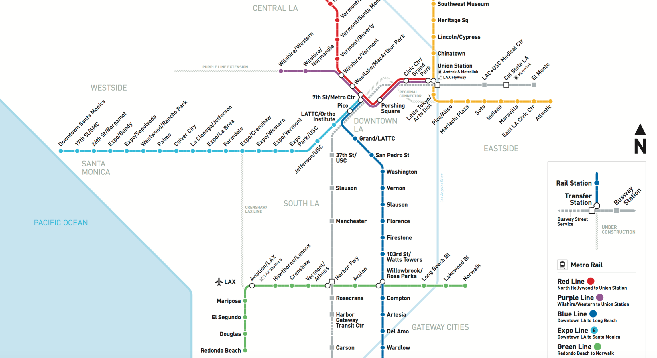
2018 Detail. Image: LACMTA.
Like a more chilled out version of Washington, D.C.'s transit guide, Los Angeles' Metro rail and busway map is subtler with thinner route lines, calming colors and a nice bit of a real estate given over to the ocean, offering the impression that you're never far from an ocean breeze. At least on paper. It also does a nice job of incorporating under construction lines and offering just enough place name information to help further orient users.
Denver
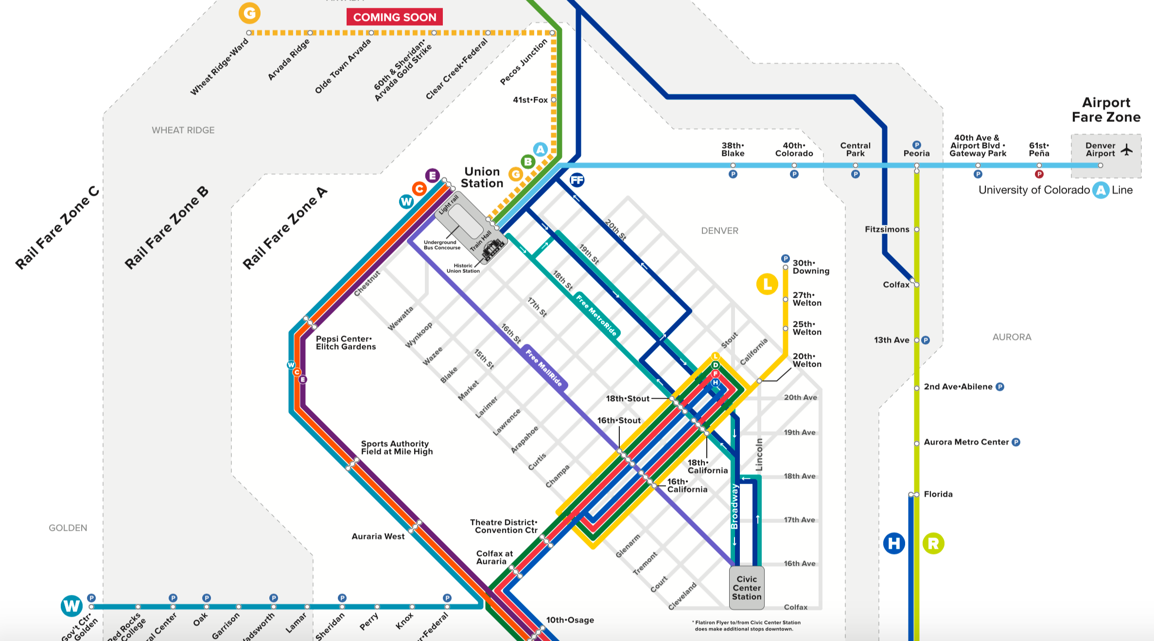
Detail. Rail and Flatiron Flyer Map. Image: RTD.
Denver has been working recently to shore up a solid regional system with frequent transit options in the urban core. Indeed, the rail map points to the regional orientation but riders can also access free-ride areas in the core, which includes shuttle stops aligned with a commuter rail along the 16th Street Mall pedestrian and transit corridor. The map manages to cram in a lot of information about different pricing zones, regional bus service, planned routes and more without being too overwhelming.
Portland
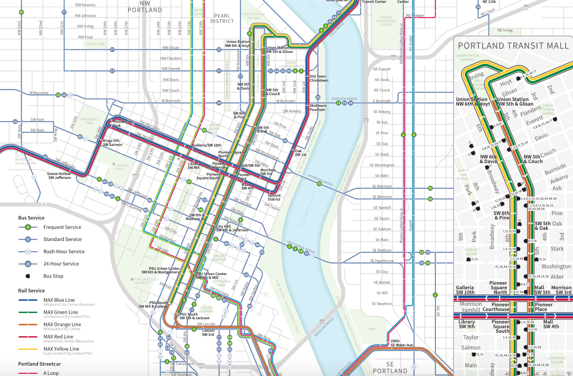
Detail of Portland City Center map. Image: TriMet.
What's nice about Portland's City Center map, though it's just a detail of the larger system, is the inclusion of information about the frequency of service. That type of information is critical for riders but often missing on transit maps. The distinction between "frequent" and "standard" service could stand to be clearer, certainly, but it's a start. It's also nice to see rail and bus service together, which can quickly get complicated if not done well, resulting in a sort of rainbow spaghetti.
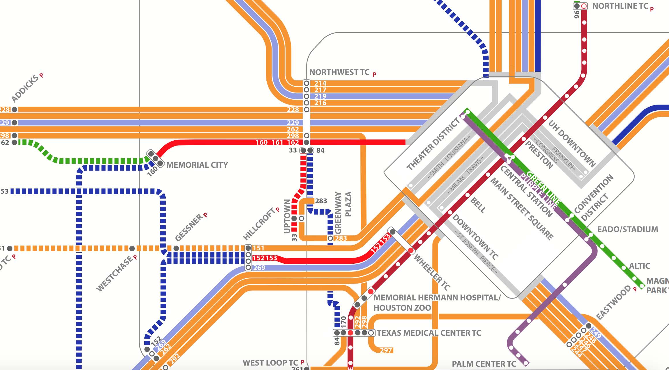
Houston
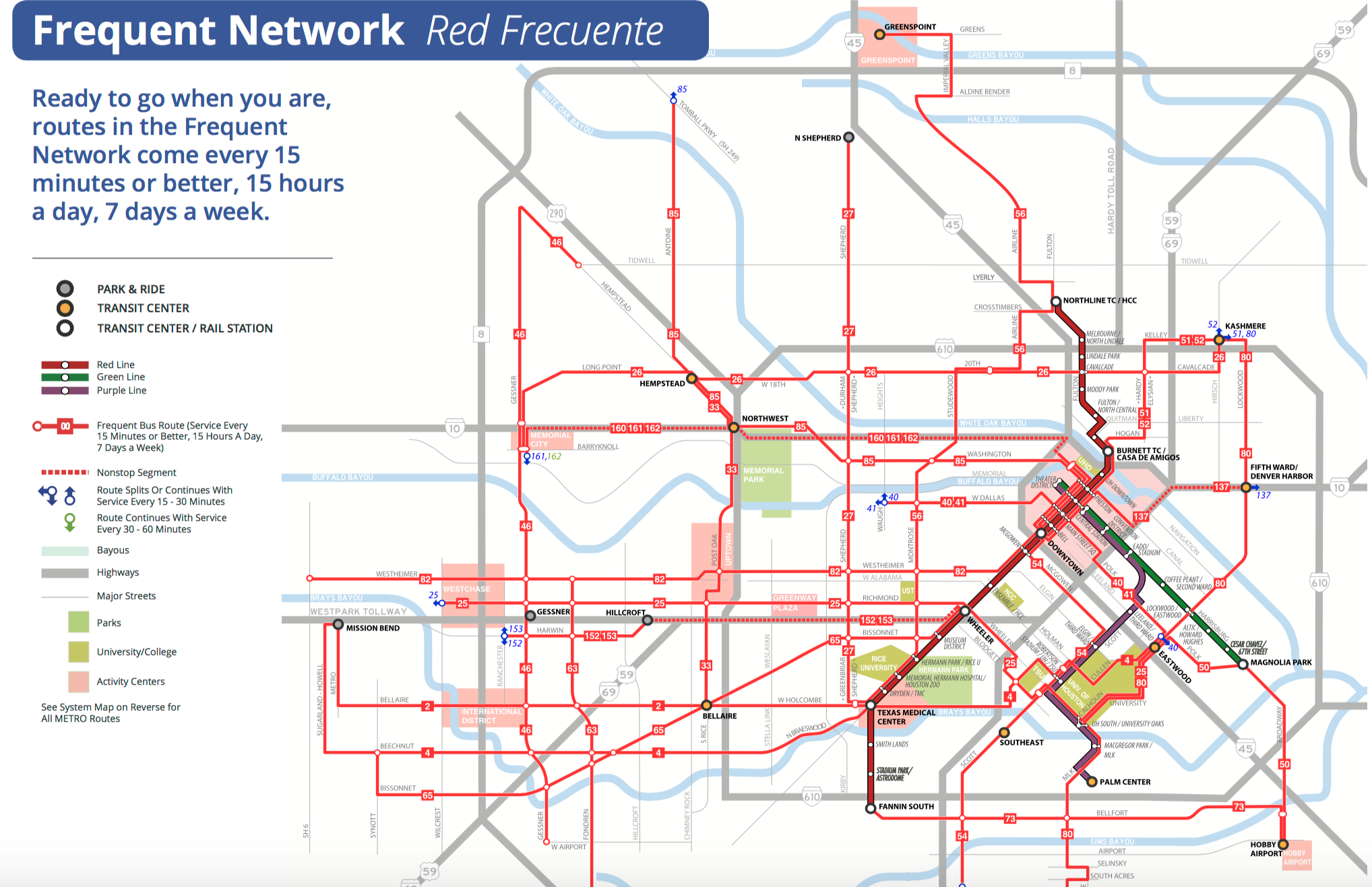
Houston Metro's Frequent Network. Image: Metro.
For a map that pretty much does it all, Houston Metro's manages the job well. It includes information about route frequency, the availability of bicycle parking, multimodal connectivity and has separate maps highlighting its high-frequency network, park and ride and service around busy destinations like downtown and the Texas Medical Center.
Of course, some of the best examples have come from other countries entirely, including Montreal's map featuring a black background, Amsterdam's park and waterway-rich rendering or Lisbon's whimsical take on transit.