
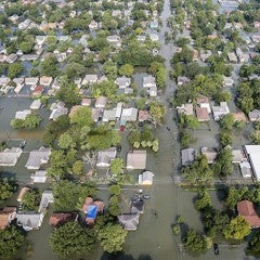
The project team identified areas vulnerable to inundation following flooding in Houston and produced an analysis that determined that 25 percent of flood insurance claims from 1999 to 2009 were located outside of 100-year flood plains. The team used hydrological modeling to document street flooding in Houston and identified problem areas. Their goal was to assess if mitigation techniques used throughout the city were successful.
Coupled Flood Alert System and Infrastructure Risk Modeling for White Oak Bayou
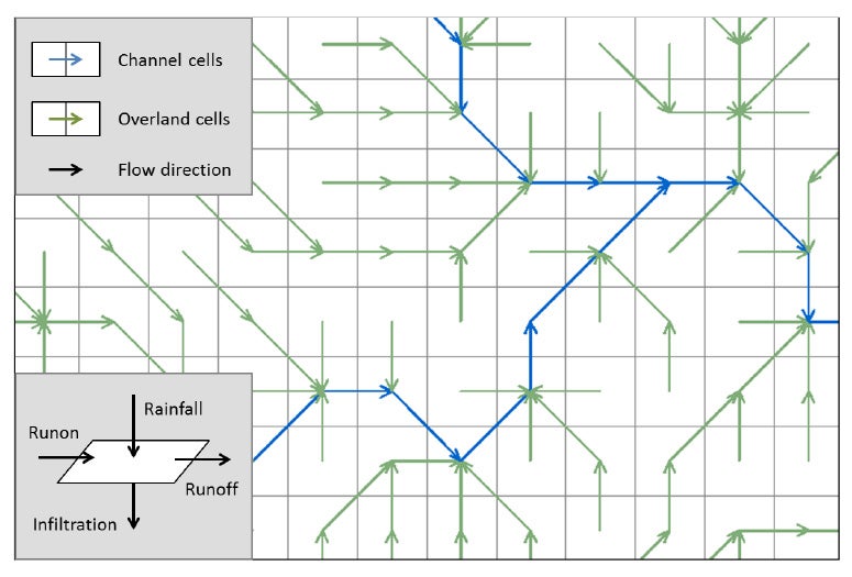
The project team developed and implemented a radar-based flood alert system as a flood mitigation tool for the City of Houston and to inform infrastructure risk modeling, focusing on White Oak Bayou.