
As of April 2017, there were just under 5 million active flood insurance policies under the National Flood Insurance Program. Since the program's creation in 1968, the 100-year floodplain has been the standard tool used to assess the flood risk for a given property. Areas inside the 100-year floodplain have a 1 percent chance of flooding each year and are generally required to buy federally-regulated insurance by lenders. But that measure has been increasingly called into question, along with the role of the flood insurance program.
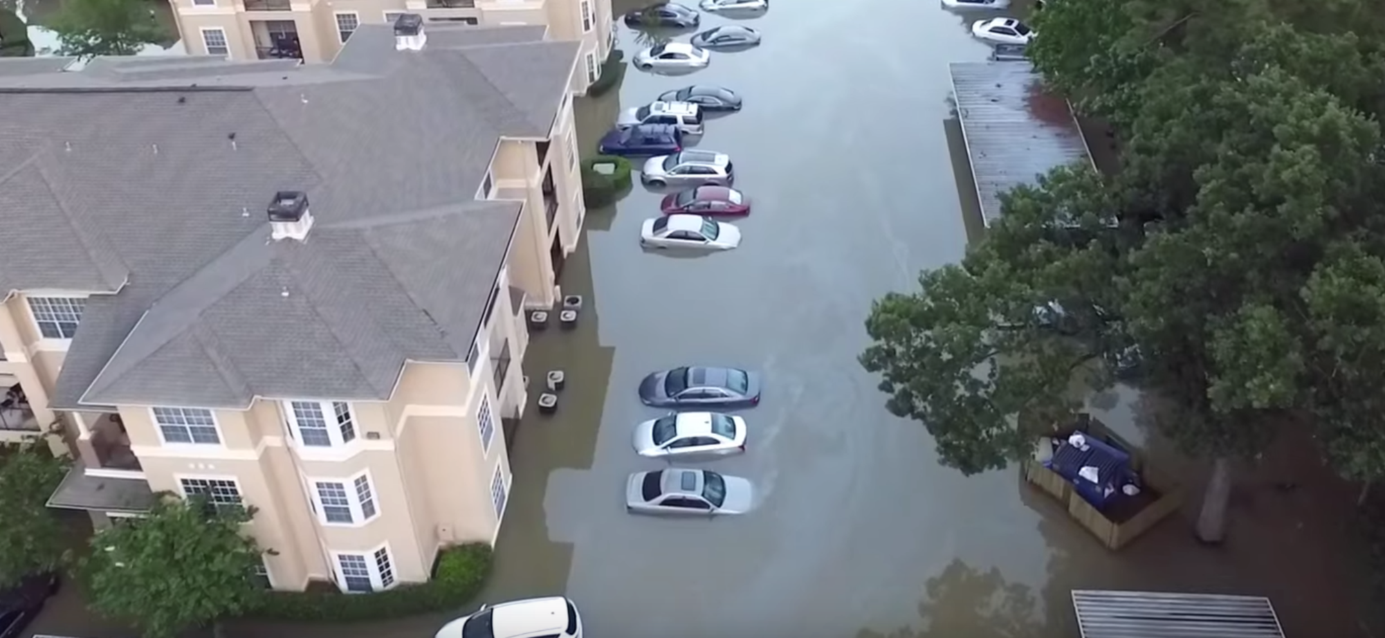
A recent study from a team of Texas researchers estimates nearly a quarter of insured flood losses nationwide come from properties outside the 100-year floodplain. That number goes up in coastal areas. In Harris County, for example, almost half of all repeat insured flood losses between 1978 and 2008 were located outside the 100-year floodplain.
The study, published online earlier this year and in print in the August issue of Natural Hazards Review, points out several major limitations to the current models used to map flood risk, including the fact that those models don't take into account changing land use, like loss of wetlands or additional impervious surfaces — both important factors in the fast-growing Houston metropolitan area.
Focusing on losses incurred during five different storm events between 1999 and 2009 in the Armand Bayou Watershed, southeast of Houston, Russell Blessing, an urban and regional science graduate student at Texas A&M University, Antonia Sebastian, a civil and environmental engineering graduate student at Rice University and Sam Brody, a marine science professor with Texas A&M University at Galveston, found some $29 million in insured flood loss in two sub-basins in the watershed. Well over half were from areas outside the 100-year floodplain, so 80 percent of the claims and 75 of the insured losses were outside the floodplain. For the most part, the age of the home was not a factor in loss. Using a different mapping tool that compares the inundation depths over the duration of a storm to those upstream, the researchers were able to expand the 100-year floodplain to cover almost 2.5 times more claims.
"In general, flood claims that the floodplain failed to capture were located in areas characterized by poorly drained soils, high imperviousness, and relatively low roughness when compared with claims within floodplain boundaries," the study explained.
Continuing to use the less accurate 100-year floodplain currently employed will likely only make the situation worse. In essence, the report noted, "it creates an environment in which riskier development decisions are more likely to occur in areas just outside of the floodplain which would actually be considered floodplain were they modeled more accurately."
In the meantime, Brody, a Kinder Institute research fellow and the director of the Center for Texas Beaches and Shores, has launched a searchable website for Houston area homebuyers and homeowners to assess flood and other natural hazards risks via an interactive map. Currently covering Harris County, the Buyer Be-Where map will soon include Galveston County as well.