
This post explores five Harvey-related datasets, but the UDP has much more—including data on Harvey’s impacts on air and water quality, federal funding for individuals and households, and power outages. Each data source contributes to a greater understanding of this disaster from multiple dimensions.
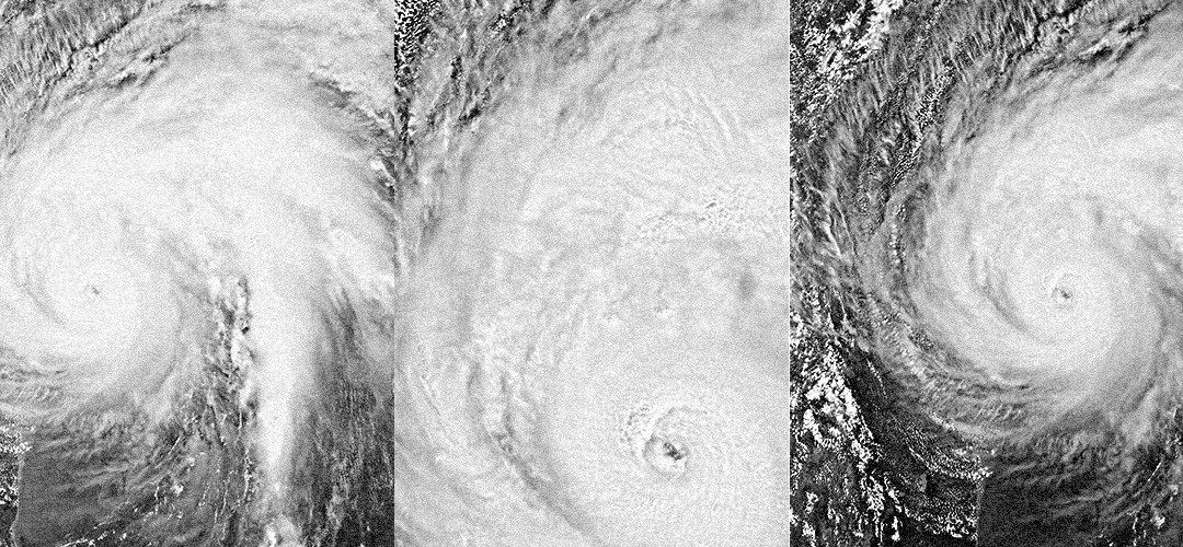
The rain
Hurricane Harvey dumped an estimated 24.5 trillion gallons of rain in Texas and Louisiana, a mind-boggling amount of water that weighed so much it actually compressed the crust of the earth by almost an inch.
The Harris County Flood Control District’s network of 153 gauges captured localized rain data as the storm stalled over the area between Aug. 25 and 30. Each gauge recorded on average 33 inches of rain, with just over 50 inches of rain recorded at Friendswood’s Mary Creek and almost 52 inches at Cedar Creek near Baytown.
For most of the Houston area, a 1,000-year storm—a rainfall that has a 0.1% chance of occurring at any time—is equivalent to about 30 inches in a 24-hour period or around 38 inches in a four-day period.
These intense rains have been making headlines—including five in US the past month alone. What defines a 1,000-year-old storm is a function of duration as well as location—a recent 1.46-inch deluge in Death Valley was considered one, for example, as it represented nearly a year’s worth of rainfall in one day.
Source: Harris County Flood Control District & Kinder Institute For Urban Research-Urban Data Platform Team. (2019). Harris County Flood Gage Readings During Hurricane Harvey (Version 1) [Data set]. Rice University-Kinder Institute: UDP. https://doi.org/10.25612/837.RA19GYQM7ANR
The damage
In the immediate aftermath of the storm, the Federal Emergency Management Agency began assessing damage to homes and other structures—a critical step to determine the scope of federal aid that would be needed to begin the recovery process.
As of Sept. 2, 2017, the agency had completed assessments for over 150,000 structures in Texas and Louisiana, including over 68,000 in Harris County. According to the preliminary findings, over 4,100 buildings were completely destroyed, nearly 6,000 received major damage and almost 20,000 sustained minor damage. Another 39,000 were rated as “affected,” meaning they sustained mostly cosmetic or other minor exterior damage.
Mapping this data shows the scars left by the storm across Harris County—scars that largely track along its bayous. It also shows which communities faced extreme hazards—including a 10-mile swath from I-45 and West Mount Houston stretching to the North Forest area.
Source: Federal Emergency Management Agency. (2017). Modeled Hurricane Harvey Damage Assessments. [Data set]. Rice University-Kinder Institute: UDP. https://www.kinderudp.org/#/datasetCatalog/01pz6g1dpzo0
The displaced
One of the challenges that government and agencies face during the recovery is knowing in advance where the needs might be most severe, so that key supplies and procedures can be put in place to start helping people as quickly as possible.
The Texas Flood Registry sought out to capture data to help agencies with this challenge. The effort included a variety of regional stakeholders: Chambers County, Corpus Christi Nueces County Public Health District, the Environmental Defense Fund, Fort Bend County, Harris County Public Health, Houston Health Department, Montgomery County, Texas Parks and Wildlife, Victoria County, and Rice University.
The registry survey was pushed out through the areas affected by Hurricane Harvey as well as subsequent floods, such as Tropical Storm Imelda.
The effort—which is still ongoing—has received over 21,000 responses related to Hurricane Harvey, providing researchers with a snapshot of the recovery, including the respondents’ location, whether they had been displaced, where they took shelter, and other questions about their condition at the time of the survey. It also asked questions about flooding damage, repairs, loss of income. It also asked about their physical and emotional health.
Because the survey was conducted using a voluntary response sample, it is likely less representative of the population at large than a survey conducted with a random sample. But it does provide some broad insight into the experiences of residents, and when the responses are mapped to neighborhoods, some patterns emerge. This map shows which neighborhoods had more than 25% of respondents reporting being displaced as a result of Hurricane Harvey.
This map uses updated, aggregated data from the latest Texas Flood Registry responses. The UDP also has aggregations of earlier snapshots that summarize the data by census tract and for Harris, Fort Bend and Montgomery counties.
Source: Children’s Environmental Health Initiative, University Of Notre Dame & Kinder Institute For Urban Research, Rice University. (2022). Texas Flood Registry [04/18/2018 - 09/30/2020] - Percentage of respondents who left their home due to Hurricane Harvey, aggregated by Houston Super Neighborhood and Community Tabulation Area (Version 1) [Data set]. Rice University-Kinder Institute: UDP. https://doi.org/10.25612/837.9YWO4R4QN481
The dollars
In the immediate aftermath of a disaster, FEMA is tasked with distributing aid dollars through three main programs—Individuals and Households Program, Public Assistance Program and Hazard Mitigation Grant Program assistance. The public assistance program allocates funding only for government agencies and certain nonprofit organizations.
These public assistance dollars can be used in certain ways, such as reimbursement for debris removal and repairing roads and bridges. After Harvey, more money was allocated to public assistance than to individual assistance, and the single biggest category of project funding fell under public building repairs.
The dataset shows which agencies were allocated funding for building repairs—including city and county governments as well as schools, churches and arts organizations. Note that even if federal funding is obligated, all projects must also include a local match.
The voices
One of the most interesting datasets available on Hurricane Harvey comes from the HONOR Project—Harvey Oral Narratives on Record.
The curated corpus of 100 interviews with Harvey survivors comprises over 56 hours of audio recordings. The archive hosted on the Urban Data Platform also includes transcripts, and metadata.
A brief analysis of the transcripts made this word cloud possible, with the top three most substantial words emerging from the text being “people,” “house,” and “water”—which is about what one would expect. But further study could explore how people reflect on their state of preparation or their understanding of the effects of the storm.
Interviews were conducted from January 27 through November 17, 2018, by undergraduate students in the Department of Linguistics at Rice University. Faculty members Robert Englebretson, Suzanne Kemmer, and Nancy Niedzielski supervised the project.
As the project notes describe, the interview subjects skew female and white, making it less representative of Houston at large, but it is nevertheless a valuable resource for capturing a slice of the Harvey experience. As one participant put it: “I think that we’re all bonded by this experience that we went through. I mean, everywhere you go, it’s almost like people ask: ‘Where were you when JFK was shot?’ It was like, ‘What was your Harvey experience like?’ … We’re all bonded together in that way.”
Source: Englebretson, R., Kemmer, S., & Niedzielski, N. (2020). HONOR (Harvey Oral Narratives on Record): A Corpus of Interviews from Hurricane Harvey (Version 1). Rice University-Kinder Institute: UDP. https://doi.org/10.25612/837.2YWJM75E35AG
