
Urban flooding caused by an increasing number of hurricanes or storms is a significant source of property loss, social disruption, and inequality in the Texas Triangle and especially in metropolitan Houston.
Ideally, communities would have the capacity to reduce their hazard vulnerabilities and increase their social resilience through design and planning, with an eye toward long-term stability. However, the silos within the design and planning communities and the gap between research and practice have made it difficult to achieve this.
As built-environment practices require higher standards that are multifunctional, experiential and sustainable, interdisciplinary collaboration is essential. Without seamless collaboration, the outcome of resilience design often presents compromised performances and lacks full considerations, leading to costly mistakes.
For example, a resilience-oriented design of a given building requires an architect. However, a single building will not realize its resilience goal without considering the trend of transforming elements of “gray infrastructure” to “green infrastructure,” where gray represents human-engineered and centralized water management approaches such as pipes, pumps, ditches, detention ponds, and drainage and sewer systems. The efficacy of these systems is critical and requires expensive maintenance and operation, which poses a huge challenge for many governments.
Meanwhile, the Environmental Protection Agency promotes the practices of green infrastructure, describing it as “natural resource management interventions that use vegetation, soils, and natural processes to manage water and create healthier environments.” Landscape architects are big advocates for green infrastructure, but a lack of collaboration among landscape architects, architects, urban planners, earth scientists and civil engineers, often hinders the implementation of effective green infrastructure. For instance, land-use policy strategies are mainly suggested by urban planners, while earth scientists study the mechanism of natural environments and civil engineers construct and maintain such infrastructures. All of these perspectives and expertise need to be integrated to ensure a resilient urban environment.
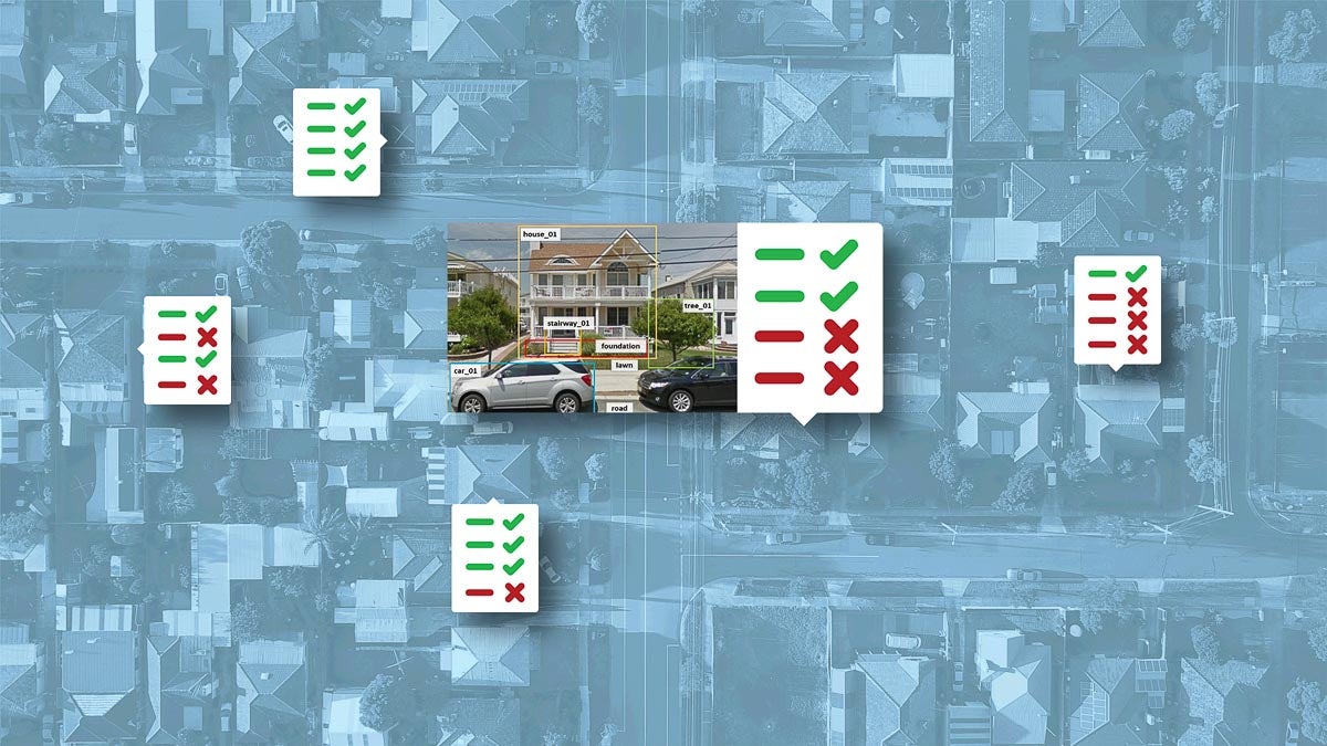
Urban planners, disaster resilience officials and residents alike need new tools for capturing ground-level insights into the built environment, and a new approach powered by artificial intelligence offers a window into what is possible.
A highly intelligent, evidence-based and data-driven system may help stakeholders shorten the lengthy analysis process and gain insights into possible solutions. It could also promote mutual learning and communication for local communities who often lack the awareness of the flood risk. This is especially crucial after a devastating disaster, when the communities desire rapid recovery and a fast decision-making process is needed.
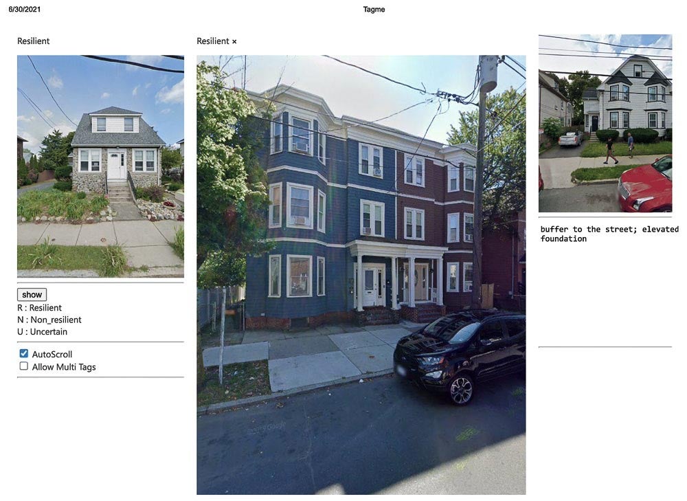
An example of the Tagme.us interface
As part of a team of researchers at Texas A&M University, we developed an AI-driven framework to facilitate multi-scale flood resilience design and planning. This platform, with the active engagement of local residents, experts, policymakers, and design professionals, could help break down barriers to effective collaboration and close the knowledge gaps that exist between on-the-ground experience and urban planners’ expertise.
In our work, we defined resilience as a system’s capability to experience disturbance and changes, and retain its function and structure for dealing with future hazard events— adapting from previous ecology and hazard research and using a built-environment design lens.
One key to this AI approach is the notion of Geodesign, which originated from overlaying a series of map layers for a comprehensive understanding of a site. Geodesign is an interactive and sequential process in the built and natural environments, requiring successive critical thinking and synthesizing across different scales (urban, neighborhood, building) and disciplines.
What is missing from existing approaches to tackling spatial challenges is a scientific framework for Geodesign that incorporates layers of information beyond a simple flood plain map.
Our team built a preliminary working prototype that allows planners and designers to collaboratively annotate images with the description of flood resilience design elements of a building, essentially creating a layer of detail about the built environment that did not previously exist.
We collected millions of street view images, where a single typical image might contain important street objects, such as front lawn, trees, and household buildings. Our annotation prototype allows users to write descriptions of resilience elements and designs of a given household. Every user is able to explicitly review others’ descriptions and leave comments. In this way, users working at different scales of resilience designs can have a common place to share their views. Our prototype also allows users to upload their own images with descriptions.
In theory, the user base could include not only city officials, but also neighborhood residents, developers and other stakeholders, which would open other avenues for collaboration.
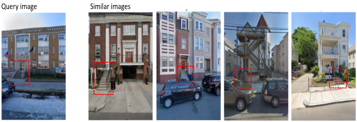
Example query with search results returning structures with similar stair entrances (highlight added)
Using our initial dataset, we also built a preliminary and simple image retrieval system using an open-source AI tool that takes an image as input to search similar images with labeled design elements.
Take, for example, an elevated foundation—an important element of resilient buildings. As seen in the example above, a user could upload a query image as input to our system, which then retrieves examples of buildings with similarly elevated stair entrances from our dataset.
Additional development of this tool could add features such as natural-language search capabilities and intelligent labeling of features.
By taking stock of the built environment with high fidelity information, planners can more rapidly assess the resilience of structures on a block-by-block, house-by-house basis. That assessment, in turn, can help guide new urban design approaches and rules as well as efforts to retrofit and rebuild communities.
As development on this approach continues, we will be advancing more ways to help planners tackle flood resilience by leveraging AI and collaboration. Through revealing fundamental design principles with implications for actions, our research can improve the nation’s flood resilience, in support of science-based measures for accessible, affordable, and universal design interventions. More comprehensive knowledge of how cross-scale resilience design criteria influence adaptive behavior can inform more effective approaches as planning practitioners reevaluate their community network of plans.