
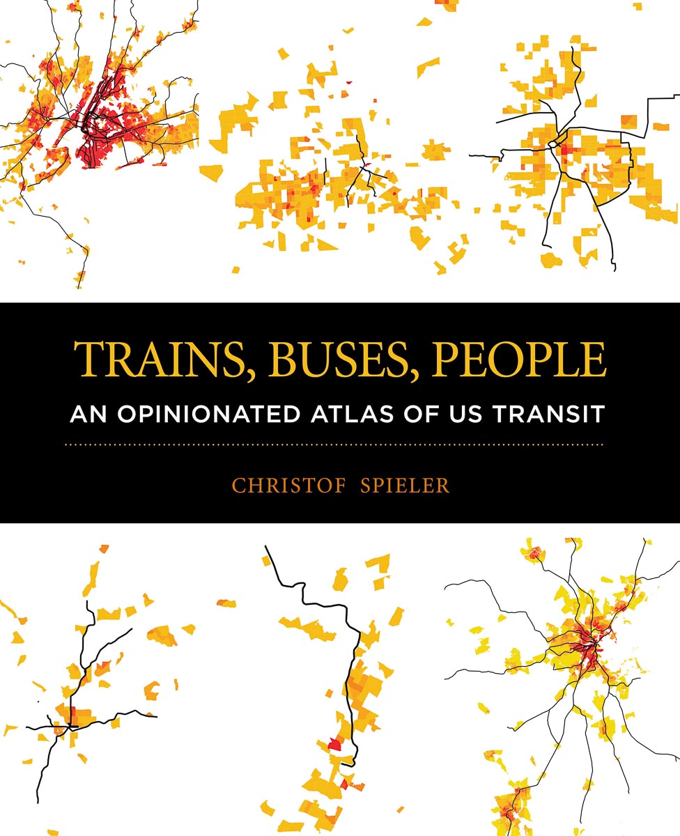
In his new book, Houston's own resident transit authority Christof Spieler answers questions like: What are the best transit cities in the U.S.? The best Bus Rapid Transit lines? The most useless rail transit lines? The missed opportunities? Using data, graphics, maps and more, Spieler, vice president and director of planning at Huitt-Zollars and a senior lecturer at Rice University, looks at the transit systems of the 47 metropolitan areas in the country that have rail or bus rapid transit. At least one of those systems, Spieler had a large hand in shaping as a Metro board member here in Houston and the architect of the transit agency's bus route redesign in 2015 that helped Houston withstand the declining system ridership trend that many other cities are experiencing.
As part of the Kinder Institute's Urban Reads series, Spieler will be in conversation with Director of Strategic Partnerships Kyle Shelton about transit, Houston and more Wednesday evening. With his new book, "...Spieler sets the rules of engagement for effective transit and offers a roadmap for achieving it," according to former New York City Transportation Commissioner Janette Sadik-Khan.
Below are two different excerpts from his new book, first, an introductory personal essay and then, a look at density as just one of several components of successful transit.
I live in Houston, Texas, a famously car-oriented city. I work at an urban planning practice, teach at Rice University, and serve on a transit agency board. I can do all of that on public transit. Almost every morning, I walk out my door, go three blocks down the street, and get on a train. It will take me to work, to meetings, to lunch with friends, to medical appointments, to lectures, to museums, to the park. I find it as convenient as driving, and considerably more pleasant. Transit makes my life better.
This is possible because the transit I live next to is high quality. The train runs every six minutes during the day on weekdays, so I rarely have to wait. It has its own lane, and traffic signal priority, so it’s not slowed down by congestion. My transit system has nice stations that shelter me from the rain, and good passenger information.
But, most importantly, taking the train for most of my travel is possible because the transit I live next to goes to the right places. It runs by lots of apartments and condos and houses, presenting me with options for living next to it. It runs by lots of office buildings, including the building where I work. It also runs by a lot of the other things I want to do in my life—socialize, learn, have fun. At all of those places, the train drops me off right in the middle of things, not in a giant parking lot or in the middle of a freeway.
More people ought to have the choice to live like this. I’m on the train every day with lots of different people, who live in different places and work in different kinds of jobs. This transit line works for them, too. Good transit offers access, opportunity, and freedom.
People who don’t ride transit benefit from transit, too. People who use transit—be they downtown professionals or minimum-wage service workers—are essential to the economy. Everybody on a bus or a train represents one less car on the road. Public transit significantly reduces the environmental impacts of cities, reducing energy use and preventing sprawl that eats up natural habitat. All of these benefits scale with ridership—as people use transit more, its societal benefits increase.
To build good public transit, which is transit that is useful to lots of people, we need to have the right conversations about transit. We need to talk about what matters—to focus on the quality of service, not the technology that delivers it; to talk about all kinds of transit riders, not just about a narrow target market; to understand that the transit experience depends on buildings and streets and sidewalks as much as it does on stations and trains; and, above all, to talk about getting transit in the right places. We also need to be willing to talk about where transit is falling short. The measure of success in transit is not miles of track or ribbon cuttings, it is whether transit makes people’s lives better. It is remarkable how much of the public transit we build in the United States doesn’t go where people want to go or when they want to go there. Some cities have built transit that has transformed the experience of living there. Some have simply built a lot of transit. Some have built very little. It is worth comparing them and drawing lessons. That’s what this book is about.
* * *
Density
Nothing matters as much to making transit useful and successful as population density. Every mile of transit costs money to build and operate. Fundamentally, the usefulness of that mile is a based on simple math: how many people will that mile of transit reach? A mile of route puts roughly a square mile of area within reach of transit. If 100 people live in that square mile, there are 100 potential transit riders; if 10,000 people live in that square, there are 10,000 potential transit riders.
Multiple research studies have attempted to quantify density thresholds for transit. At somewhere around 3,000 people per square mile, it makes sense to operate some level of infrequent local bus service. This level of density is common in US cities, both in prewar neighborhoods and postwar car-oriented suburbia. Here, while an hourly bus will get ridership, transit will never be the most convenient mode, and most people will choose to drive. Somewhere around 10,000 people per square mile, though, transit reaches a tipping point. Here, the sheer number of people are enough to justify frequent service. Moreover, walking and biking become useful for short trips, which makes it easier for people to live without cars and makes transit more desirable. As densities further increase, more and more transit is justified. The transit- oriented neighborhoods of older cities have over 15,000 people per square mile, and even newer car-oriented cities like Los Angeles and Houston have some neighborhoods at these densities.
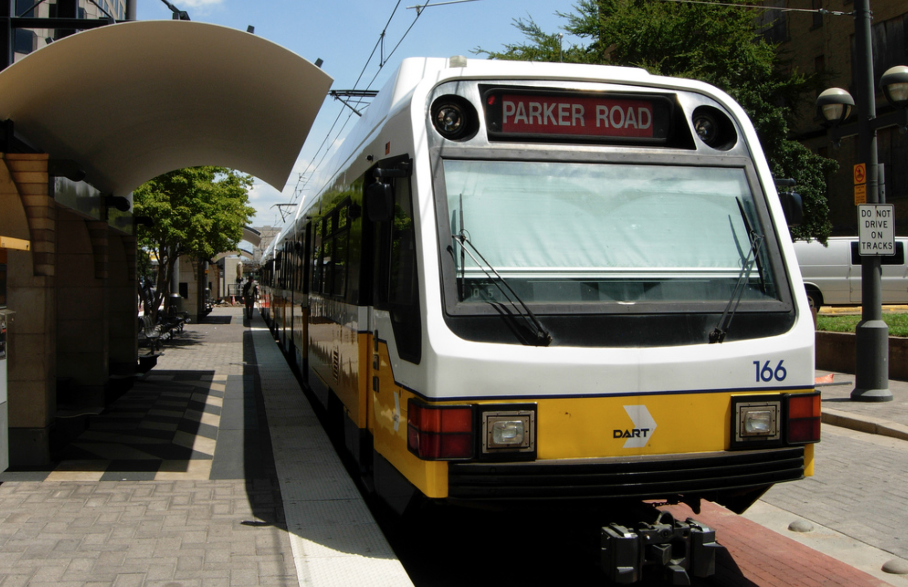
The performance of a rail or BRT line is directly related to the surrounding densities. For example, the most successful light-rail systems in the United States—San Francisco, Boston, Philadelphia, Seattle, Newark, Jersey City, Buffalo, and Houston—serve large areas of over 10,000 people per square mile.
Put transit in densely populated places. The fundamental math of density leads to an obvious rule: put transit where the people are. Successful transit needs to go where population densities are highest.
Unfortunately, this is surprisingly uncommon. Across the United States, transit service often doesn’t match density well. There are several reason for this. One is that density has shifted. Some older neighborhoods have lost population density over the past few decades, while other have gained. Networks that have remained relatively static—including most bus networks—have not reflected these changes.
A second reason is that transit planning is often based on perceptions, not reality. Some areas that people consider “suburban” are actually quite dense.
A third reason, perhaps the most influential, is that building transit in dense areas is more difficult. Streets trend to be narrower, traffic tends to be heavier, land is less available, and there are more residents and businesses to upset.
Increase population density where transit is. The least expensive way to increase the number of people around transit is to build more places for people to live along existing transit lines. The transit industry now calls this “transit-oriented development,” but it has been happening as long as transit has existed. Large parts of New York redeveloped from small, single-family houses into brown- stones and apartments around new subway lines.
Almost every transit line has room for new development along it: vacant lots, surface parking, aging single-story retail, underused industrial tracts. Even areas that already have density can be densified, and often the market supports dense new development in areas that already have an established residential market better than in relatively undeveloped areas.
In city after city, the real estate market has proven to support new development around transit. Despite the claims of some anti-transit think tanks, mixed use around transit is the result of market demand, not a plot led by city planners. In fact, local governments actually do the reverse. Across the United States, city zoning ordinances limit the density of development around transit. Most cities also require parking in all new development, regardless of how convenient it is to transit, forcing people who choose not to own a car to pay for space to park one. Without government limits on land use, areas around transit would have more residential units—and less parking—than they do now. What good government policy can achieve, though, is making sure that some of the new development is affordable.
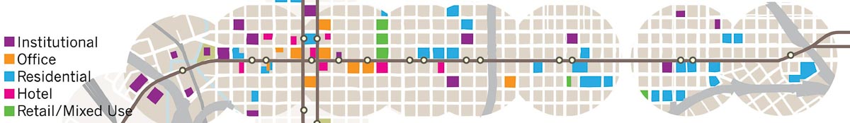
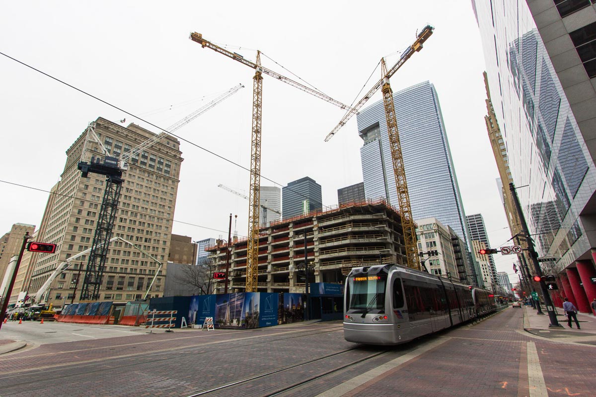
New development along Houston rail.
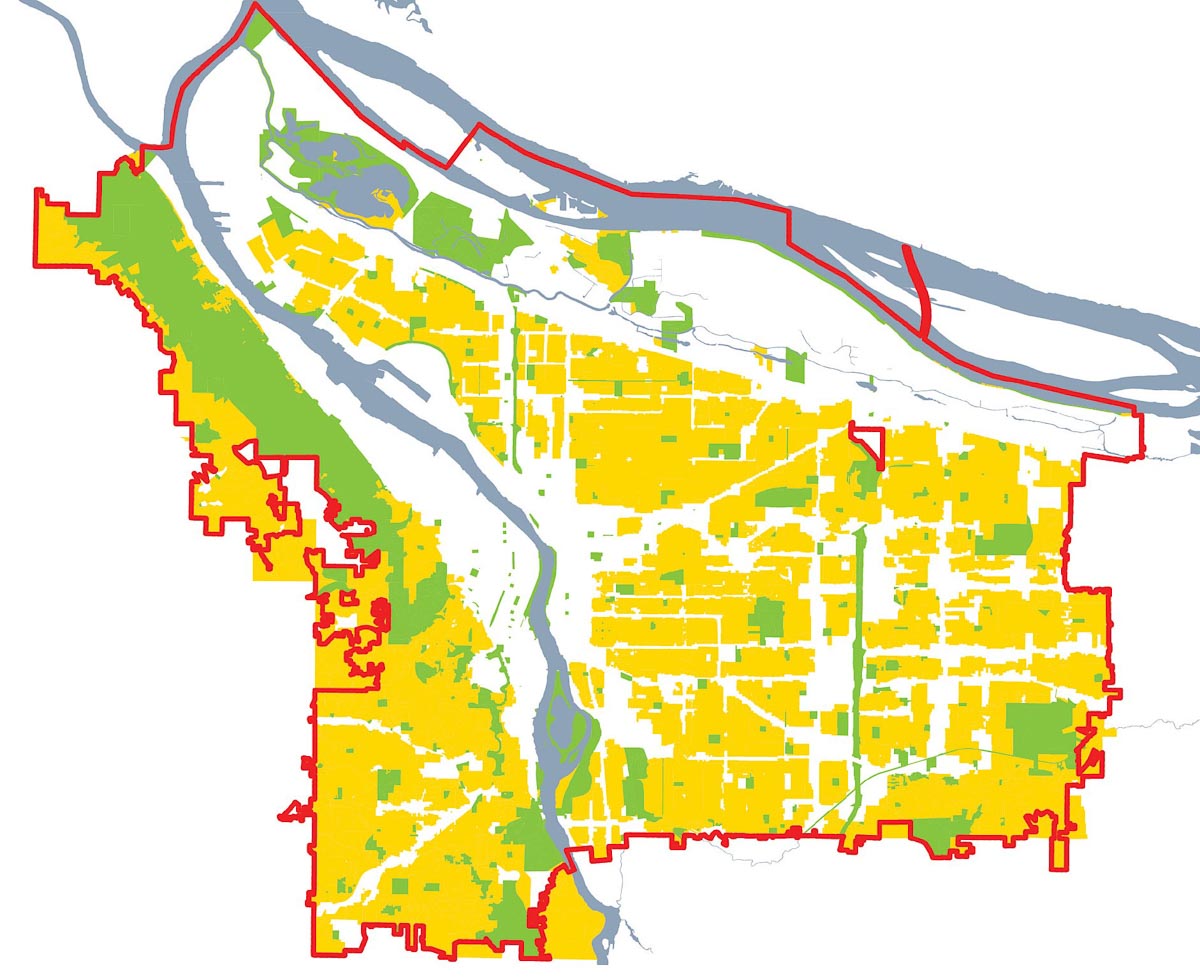
Portland, Oregon.
Houston built its light rail through already dense areas and has seen over $5 billion in new development since it was completed. The map above shows new development started since construction began on the rail line. Often, though, land-use regulations limit new development along rail lines. Portland, Oregon, is considered a transit-friendly city, with a long history of development along transit, but 42% of the land within the city is legally limited to single-family homes (shown in yellow in the map above), capping the density there regardless of market demand.
Rather than serving density, many rail lines seem to avoid it. The figure below shows multiple light-rail and commuter rail systems, at a consistent scale overlaid on density. Many follow former freight rail lines, which are often in unpopulated industrial corridors. Some were deliberately kept out of denser areas to avoid political opposition.
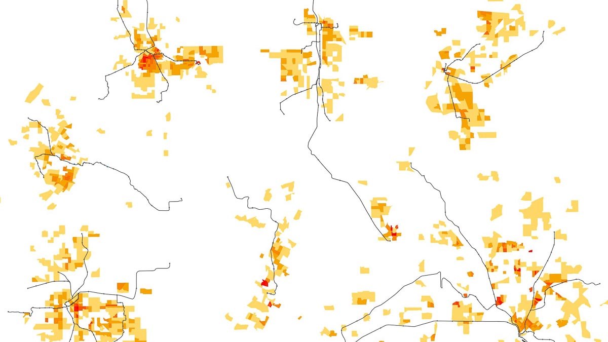
Moving clockwise from the bottom left corner: Denver, St. Louis, Minneapolis, Salt Lake City, Sacramento, Dallas and Austin.
From Trains, Buses, People: An Opinionated Atlas of US Transit by Christof Spieler. Copyright © 2018. Reproduced by permission of Island Press, Washington, D.C.